
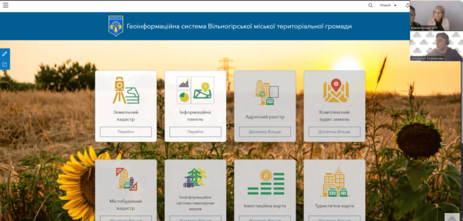
Vilnohorsk urban territorial community of Dnipropetrovsk region took a significant step in the direction of digital transformation, becoming part of the initiative of digital communities of Ukraine.On May 30, 2025, the director of MagneticOne Municipal Technologies, Volodymyr Podobivskyi, conducted an online presentation for community representatives of the “Community Land Resources Management” module of the geoinformation system.
At the heart of this system is the ArcGIS platform, which makes it possible to form a complete picture of land use in the community.
The land cadastre module became the heart of the new digital tool. Its implementation made it possible to bring land accounting to a qualitatively new level: from now on, data on each plot is stored in electronic form, which greatly simplifies the registration of rights, analysis of legal changes and control over the use of territories.
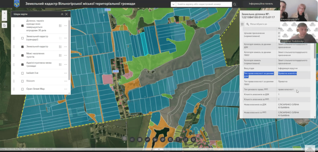
Key advantages of this system:
-
accurate land management: each plot is recorded in the system, which allows you to monitor its intended use and build development plans based on real data;
-
electronic registration of rights: residents can quickly and transparently issue documents without red tape;
-
forecasting and planning: with the help of GIS, the community receives tools for analyzing trends in the field of land use and developing strategies for future development;
-
integration: the system is easily connected to other state and municipal platforms, forming a single digital space for making management decisions.
Thanks to this decision, the Vilnohorsk community not only modernizes its administrative infrastructure, but also becomes closer to the needs of its residents, creating an environment in which it is comfortable to live and develop.
More about GIS management of community land resources bylink