Geoinformation system of waste management

Geoinformation system (GIS) of waste managementis a modulegeoinformation system of the communityorregion, which serves as a decision-making tool in the field of solid waste management, a means of visualizing the current state and phasing of the implementation of local and regional waste management programs.

The product is recommended for implementation at the regional (regional) and local (territorial community) levels and is developed in accordance with“National waste management strategy in Ukraine until 2030”, which was approved by the Decree of the Cabinet of Ministers of UkraineNo. 820 of November 8, 2017 and Resolution of the Cabinet of Ministers of Ukraine No. 117 of February 20, 2019.“On approval of the National Waste Management Plan until 2030”.
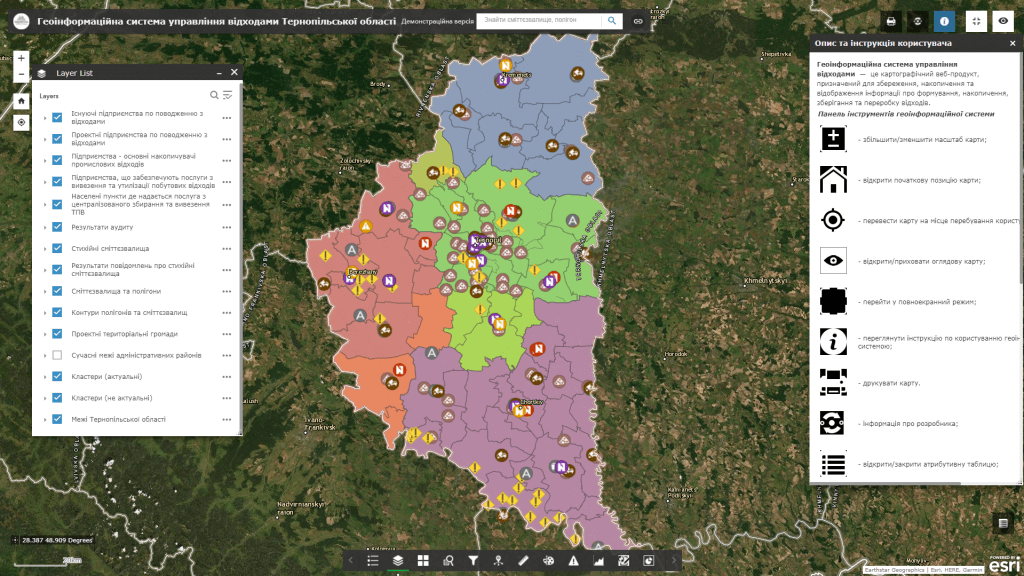
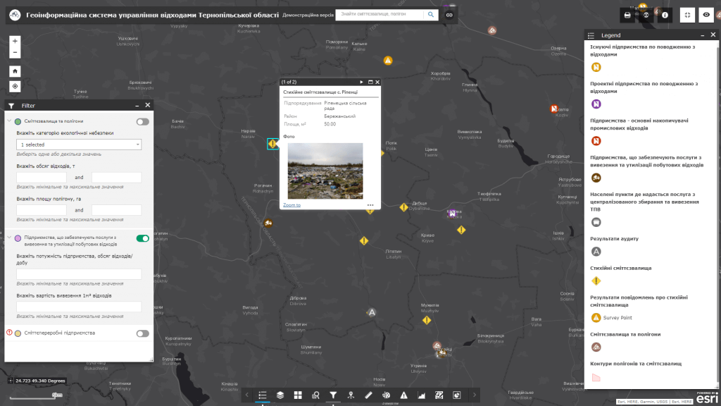
GIS of waste management is designed to solve a number of problems related to the collection of information on the current state (inventory) of landfills and solid waste landfills, their certification, visualization of schemes for sanitary cleaning of settlements, development and optimization of logistic schemes of routes of waste collection equipment for collectionand removal of waste in the relevant territory, development of ecologically and economically optimal solid waste management practices.

Capabilities of the geoinformation system:

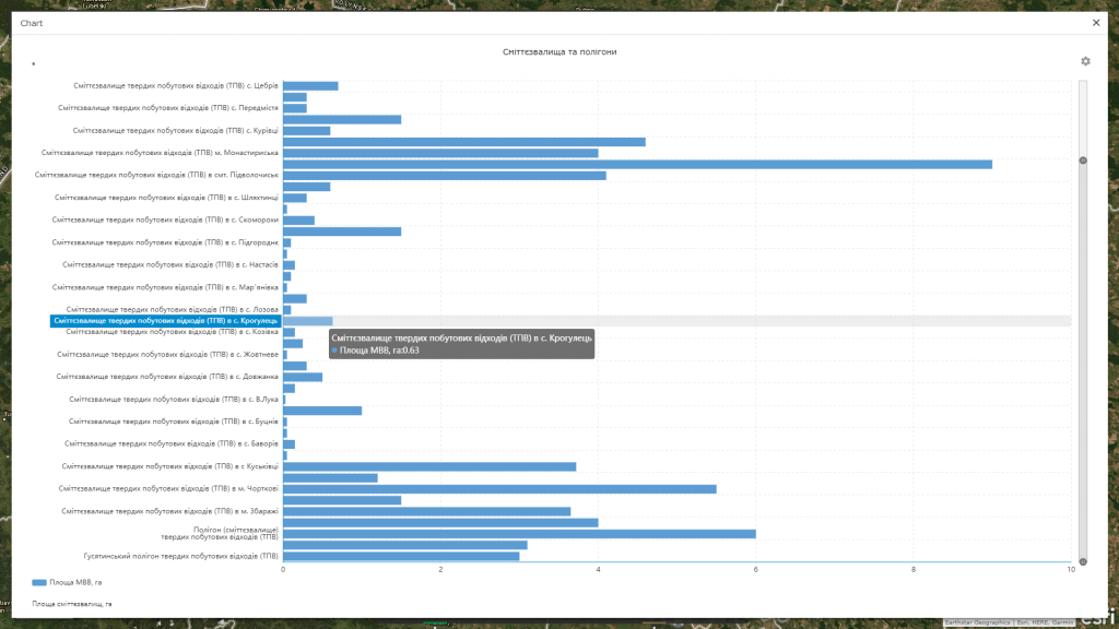
  • the availability of tools for inventorying the state of landfills and solid waste landfills using real-time mobile technologies and unmanned aerial vehicle (UAV) technologies, creating a data bank based on them (including 3-dimensional models) of solid waste storage sites;
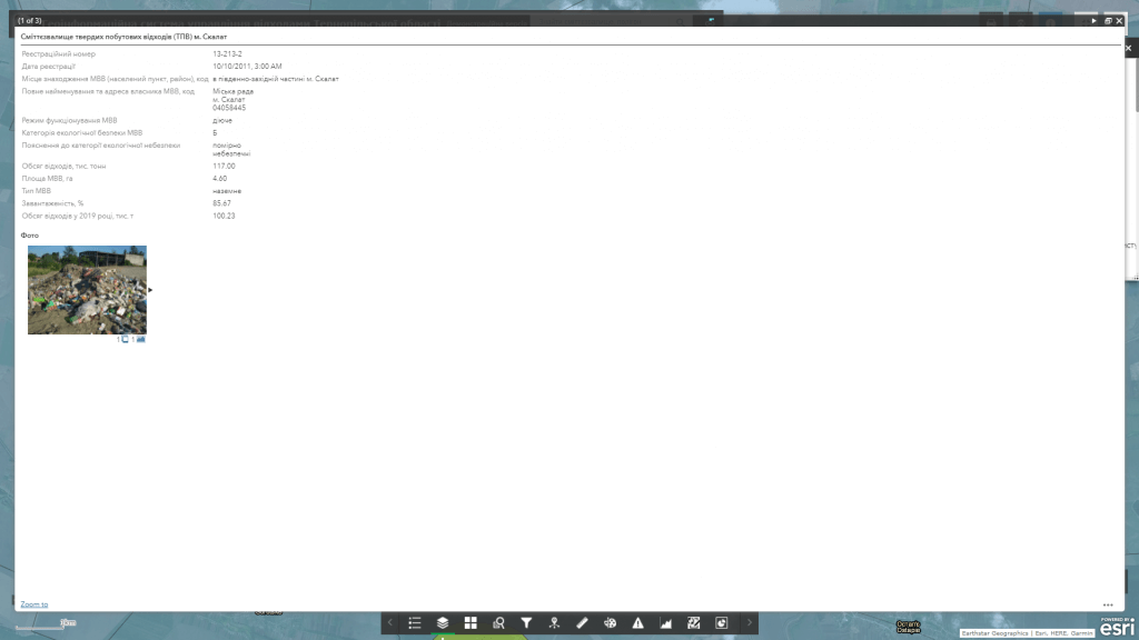
  • certification of landfills and landfills, creation of databases on MSW storage sites and morphological features of landfills; formation and display of optimal logistic schemes of waste collection equipment routes;
  • planning specific prospective measures regarding the technical and operational equipment of landfills, forecasting the future condition of areas and other geometric parameters of landfills, developing a strategy for optimal concentration of waste storage and removal sites;
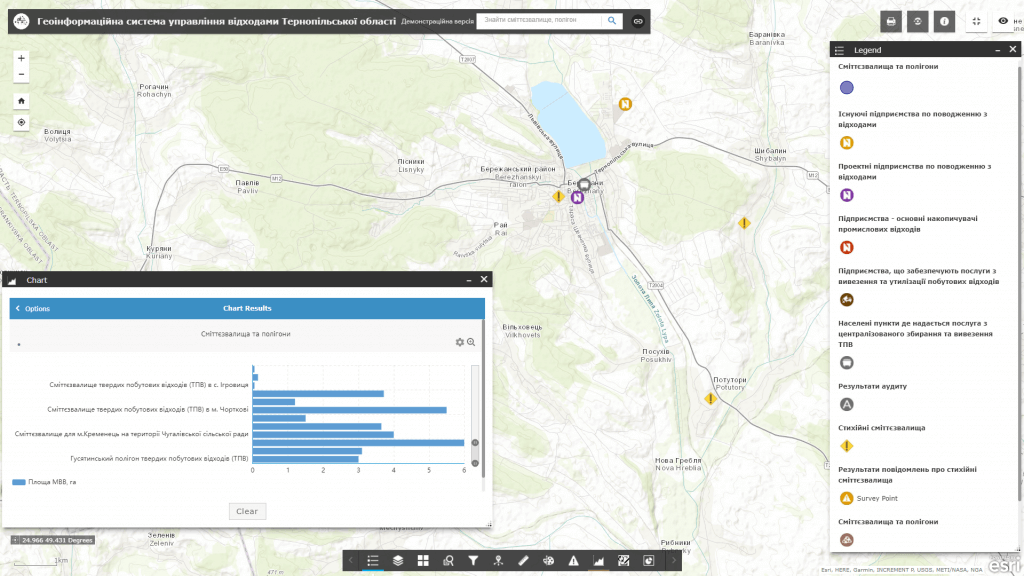
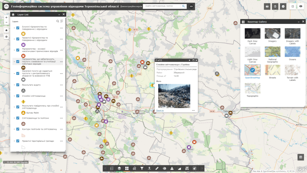
  • visualization on an interactive map of existing and promising vector schemes for sanitary cleaning of settlements in the mode of combining with urban planning documentation and land cadastre, a system of cartographic services (Google Maps, OpenStreetMaps, etc.), which allows for a comprehensive approach to solid waste management;
  • availability of a subsystem of citizens’ electronic appeals and a platform for their prompt analysis;
  • ensuring the function of information support of local self-government bodies when making decisions in the field of environmental safety of the population, risk management, automation of reporting on the results of environmental works.

Benefits of implementing a geoinformation system:

  • accounting for locations of landfills and solid waste landfills;
  • logistical support for the implementation of regional and local targeted waste management programs;
  • minimization of costs for sanitary maintenance of territories;
  • increasing the level of improvement of the territory, improving the state of ecology;
  • strengthening interaction between the authorities and the community, mobilizing members of the relevant territorial communities in solving the problems of solid waste management;
  • achieving a high level of awareness among citizens regarding solving the problems of collection, removal and disposal of solid waste.

Approximate structure of the database of the geoinformation system

  • basic geoinformation resources:a single electronic cartographic base that reflects the modern administrative and territorial structure of the territory, natural resource potential (relief, soil and vegetation cover, river network, mineral resources) and geographical conditions of the territory, road transport and engineering infrastructure, register of geographical names, etc.;
  • thematic information resources:the layers of the geoinformation system reflect landfills and solid waste landfills, waste disposal sites, waste collection equipment (containers), transport bases, transshipment and sorting sites (garbage transshipment or sorting stations), waste disposal (landfills) or waste processing (plants), vector schemes for sanitary cleaning of settlements and much more.

Cost and terms of order fulfillment

MagneticOne Municipal Technologies provides a full range of services related to the development of a geoinformation system: supply, installation and configuration of hardware and software, preparation (scanning and digitization) of the customer’s documentation for entering data into the GIS, filling the GIS database with information, training the Customer’s specialists, technical support and support of the geoinformation system. Development terms are agreed upon additionally.

Services that precede the implementation of the geoinformation system

  • Консультування
  • Сканування паперових документів та карт
  • Просторова прив'язка картографічних матеріалів
  • Оцифрування
  • Наповнення бази даних ГІС