
Use the advantages and new possibilities of managing agriculture and its main resource – land based on geoinformation systems, get the opportunity to share a database that is constantly growing. Apply GIS technologies to develop and analyze a much larger number of options for project solutions, create recommendation and management maps in the agrosphere.Speed up and improve the efficiency of the decision-making process, provide answers to queries and spatial data analysis functions. Get the ability to display the results of the analysis in a visual and easy-to-understand form. Solve tasks related to providing access to information at the request of planning authorities, resolve territorial conflicts (self-occupation of land, inconsistency of the actual use of land with the target), choose optimal (from different points of view and according to different criteria) places for placing objects, etc.
Geoinformation system for agriculture
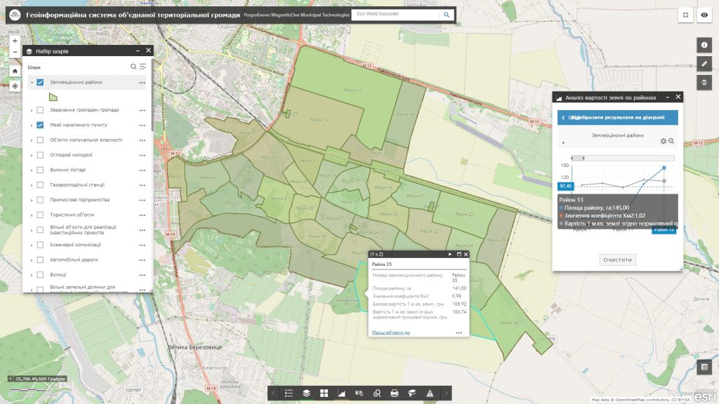
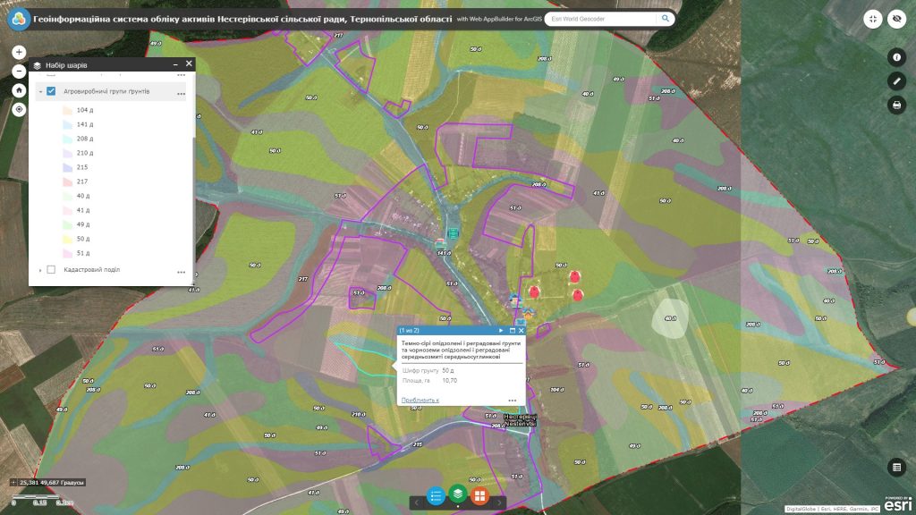
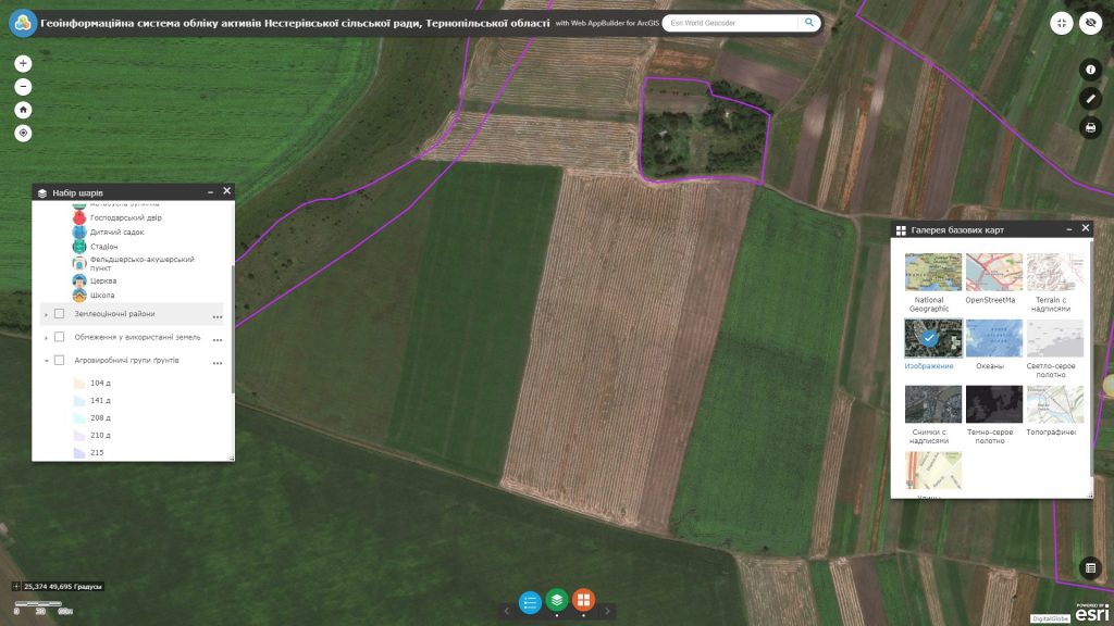
Increase the efficiency of agricultureby implementing GIS
- carry out centralized storage and management of the cartographic database of the agricultural enterprise (the resource contains information about the boundaries of land plots and agricultural lands, cartograms of agro-production groups of soils, crop rotation projects, agrotechnical passports of land plots, land allocation projects with all accompanying documentation, digital relief models, orthophoto plans, etc.);
- effectively manage land resources: promptly resolve territorial conflicts and illegal seizure of land, monitor landowners and land users;
- monitor the performance of agricultural work in the fields, keep trackcrops by crops and fields;
- evaluate the quality of soils, their potential yield, agro-ecological condition, degradation processes (classification of agricultural lands, selection of especially valuable soils, nature of soil cover, distribution of lands by steepness andexpozation of slopes, pollution by chemical products);
- analyze the efficiency of farming. Justify the expediency of land allotment and land formation, the compliance of the intended use of land with the agricultural production potential of the soil, the effectiveness of growing crops, etc.;
- carry out operational audits of agricultural land, monitor the activities of remote (field) workers (land surveyors, agronomists). Enable real-time spatial data collection in the field with a mobile mapping application connected to an interactive map.
- automate the process of reporting, planning and forecasting the development of the industry.
Approximate database structure Geoinformation system for agriculture
- basic geoinformation resources: a single cartographic basis in the form of detailed digital orthophoto plans of the area and a register of geographical names;
- thematic information resourcessupplemented with the corresponding attributive component: system of agricultural land with multi-aspect attributive (semantic) information: geometric data, nature of use (type of land, type of actual agricultural crops), indicatorsgland cover (capacity of the humus horizon, humus content, granulometric composition, level of erosion, rockiness, salinity, salinity, acidity, waterlogging, etc.),erosion-dangerous areas and others;
- complex or problem-oriented information resources –multi-layer electronic map of the farm (mesorelief, steepness and exposure of slopes, their microclimate, groundwater level, humus content in the soil, etc.) with a database of field history.
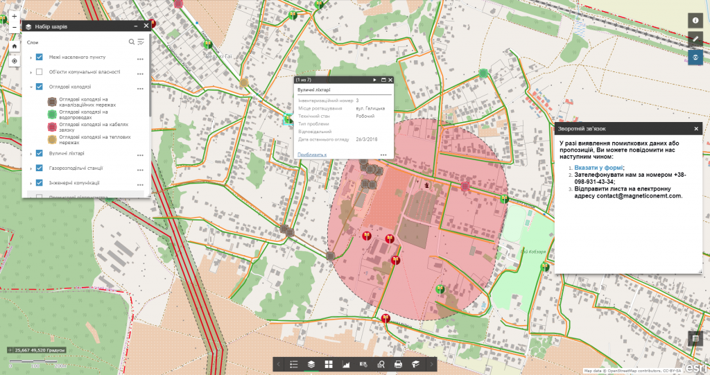
Services that precede the implementation of the solution
- Consulting
- Scanning maps and documents
- Georeferencing cartographic materials
- Digitization
- Geospatial database population


