Geoinformation management system for demining of the region
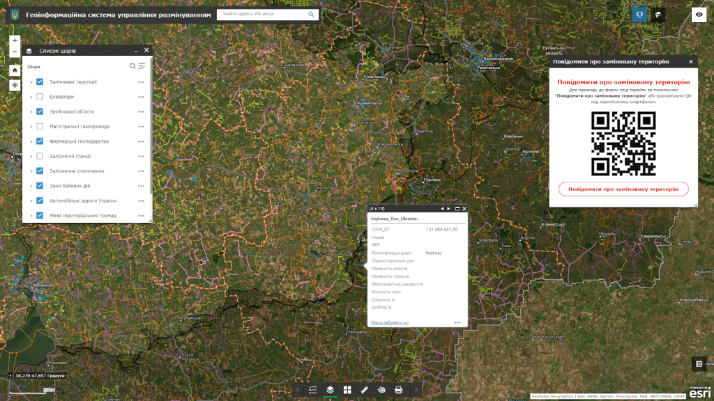
Geoinformation management system for demining of the region– is a cartographic Internet resource that acts as an actual source of information about mined areas at the level of a specific region, contains a system of tools for viewing and searching for dangerous zones, their visualization, downloading and distribution. The product is designed to provide executive authorities at the oblast level with reliable information necessary for demining management of the entire territory of the oblast.
The development and implementation of GIS for the demining management of the region is becoming a critically important task at the regional level.Geoinformation management system for demining of the region– a comprehensive decision-making platform in the direction of demining management, built on the basis of geo-information technologies. This platform is intended to provide the user (the head of the specialized department of the OVA, the head of the regional emergency department) with comprehensive information about the security infrastructure and structure of the region (city, community and region as a whole).
Capabilities of the geoinformation system of demining management of the region:
an intuitive system for recording and conducting audits of mined areas of the region in real time on an electronic map;
integration of field data collection processes, operational monitoring of equipment;
a convenient tool for collecting and maintaining a database of agrochemical indicators of soils in order to detect the level of mine contamination;
operational search for explosive objects in designated agricultural areas within the framework of ensuring the food security of the state.
the user does not need special software to work, it is enough to have a web browser and an Internet connection;
the possibility, in addition to textual descriptions, to record a photo report of the mined territory, to transmit its exact coordinates;
round-the-clock possibility of fixation, constant readiness of the resource for work;
Carrying out external control of demining quality by means of public and professional audit;
the ability to process large volumes of object audits, collect data on mined areas and monitor their demining;
regulated access to information resources thanks to the assignment of roles to system users (administrator, operator, editor);
operational search for explosive objects in designated agricultural areas within the framework of ensuring the food security of the state;
the use of unmanned aerial vehicles (drones) with a magnetometer to detect metal objects, including mines and explosive devices;
processing and analysis of data received from magnetometers to create maps of magnetic anomalies.
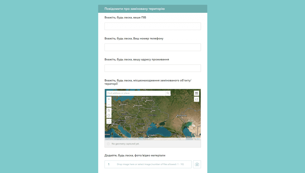
possibility to inform about demining of the territory through the feedback form.
Advantages of using a geoinformation system for demining management for regional level management:
automation of recording, accounting and subsequent demining of the territory by implementing electronic services for registration and exchange of spatial information;
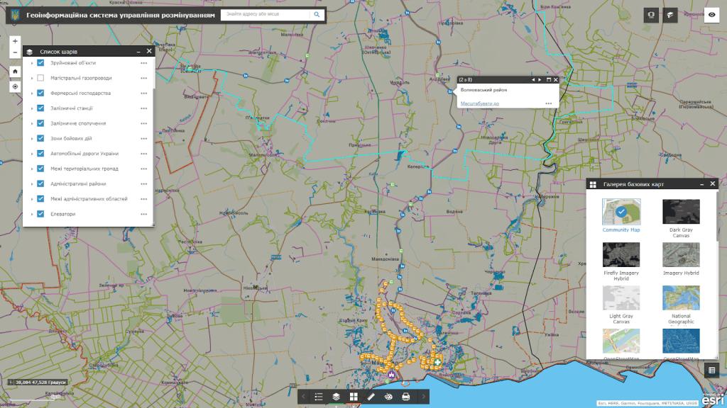
visualization of the actual state of the land on an electronic map;
operational access, administration and updating of information on the progress of works on fixing mined areas.
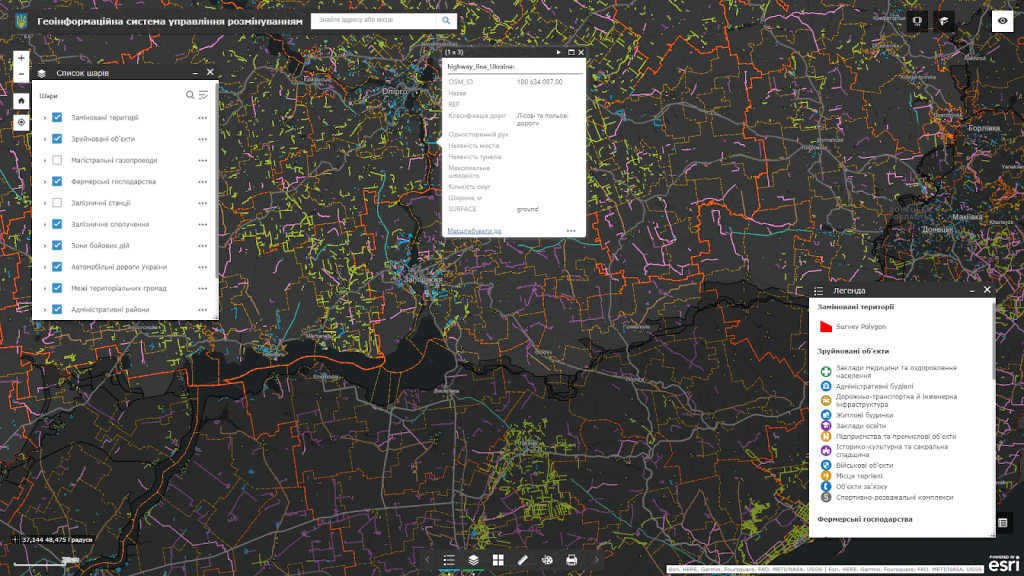
Geoportal dataset:
modern administrative and territorial structure of the region;
satellite images of the area in the pre-war period (images of the area obtained from satellites before the start of the war);
graphic representation of the relief of land plots that can be mined;
information about objects on which mines may be installed, including bridges, buildings and other objects;
geographical data on areas where hostilities are taking place;
information about territories where demining has already been carried out and the absence of mines has been established.
The cost and thatroomand order fulfillment
MagneticOne Municipal Technologies provides a full range of services related to the development of a demining management geoportal, namely supply, installation and configuration of hardware and software, filling the map with data, training specialists, technical support and support of the geoportal. Development terms are agreed upon additionally.