
Energy and sustainability
Spatial analysis of the energy system
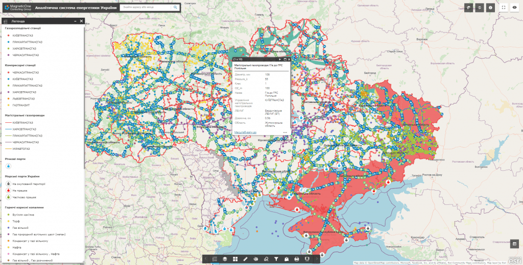
The platform combines infrastructure, generation, consumption, technical indicators, risks and territorial context to plan development and improve energy sustainability.
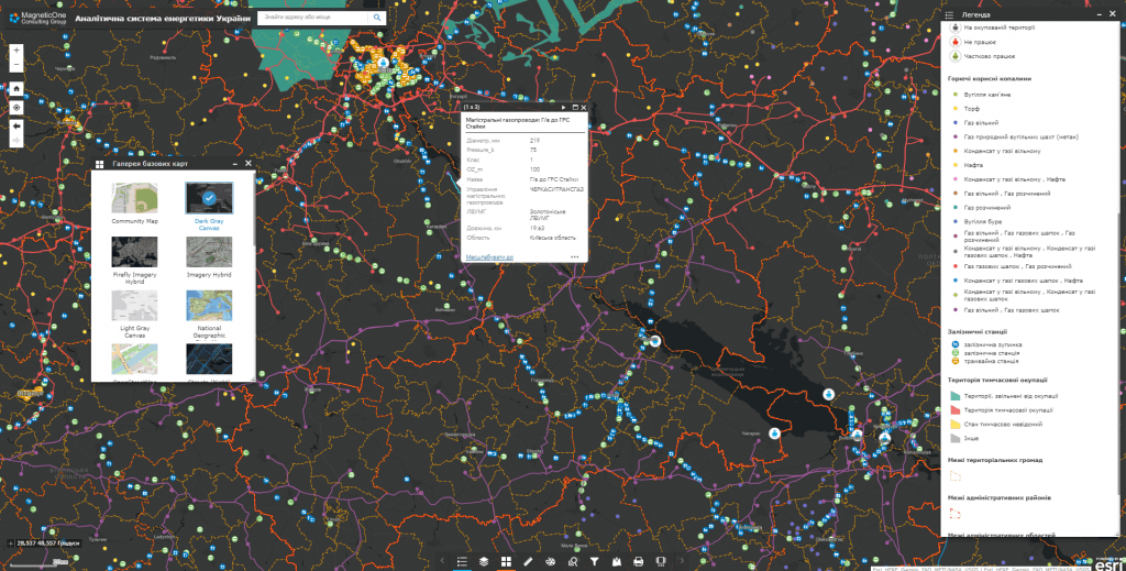
For which management decisions
Energy Intelligence supports strategic and operational vision without publicly disclosing sensitive critical infrastructure data.
Balance and load
Analysis of the placement of generation, consumption, network constraints and areas of deficit.
Development of networks
Comparison of modernization options taking into account demand, technical condition and plans for the development of territories.
Resilience
Spatial analysis of risks, redundancy, critical consumers and recovery scenarios.
Decarbonization
Assessment of the potential of renewable sources, energy efficiency and local energy projects.
What data does the system combine
The list of sources is determined during the discovery stage. The system can combine spatial, registry, statistical, documentary and operational data without public disclosure of information with limited access.
Infrastructure
- generation facilities and substations
- networks and technical parameters
- critical and social consumers
Indicators
- production and consumption
- load, losses and quality
- planned and emergency works
Territory
- town planning plans
- land and environmental restrictions
- risks and infrastructure availability
Projects
- modernization programs
- objects of distributed generation
- energy efficient measures
Key analytical modules
The composition of the modules and the details of access are determined by the role of the customer and the mode of operation with critical information.
Energy map
Unified spatial register of objects, connections, passports and technical documentation.
Balance panel
Comparison of generation, consumption, reserves and dynamics by territories and periods.
Sustainability scenarios
Modeling the impact of failures, restrictions, changes in demand and connection of new capacities.
Modernization portfolio
Prioritization of investment projects and control of their preparation and implementation.
How implementation works
We define management tasks, users, available data and access requirements.
We agree on classifiers, indicators, integrations, quality rules and updates.
We configure priority maps, panels, analysis scenarios and user roles.
We connect new territories, sources, modules, reporting and support.
Usage levels
Architecture can be formed for a national level, a ministry or public agency, a region, a municipality or an individual organization. Each level gets its own set of data, powers, indicators and reports.
National level
Strategic picture and cross-industry scenarios.
Region
Energy profile and development priorities of the region.
Municipality
Energy efficiency, local generation and critical consumers.
Operator
Assets, technical indicators, works and investment program.
Related solutions and services
The platform can work as an independent analytical system or as an add-on to existing registers, geoportals and industry systems.