Geoinformation system of outdoor lighting networks

Geoinformation system (GIS) of outdoor lighting engineering networks– a module of the geoinformation system of the territorial community (utility enterprise), intended for saving, accumulating and displaying information about the city’s engineering infrastructure.

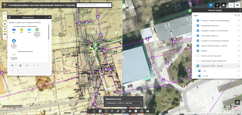
The software complex provides the user with a wide set of tools for creating, filling and editing electronic maps, developing plans for organizing work during planned and emergency shutdowns, creating maintenance route maps by bypass method, as well as modules for accounting for lamps, supports, power lines and energy efficiency planning of outdoor lighting networks, etc.
Features of the Geoinformation System of outdoor lighting engineering networks

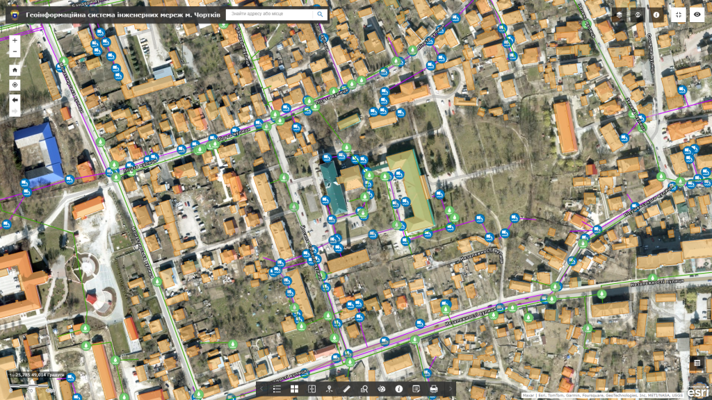
  • display of infrastructure objects of outdoor lighting networks (lamps, supports, power lines, etc.);
  • connection to a set of display of space images, orthophoto plans, urban planning documentation, raster network diagrams, etc.;
  • display of detailed technical parameters of outdoor lighting networks (type of lamp, its power, voltage, material and height of supports, dates of commissioning and last repair, number of cables, voltage, etc.);
  • execution of spatial and attributive queries, the possibility of searching, group editing of data;
  • provision of operational inventory of outdoor lighting networks and elements in real time using mobile devices;
  • implementation of public electronic appeals and registration of incidents by citizens on the networks (emergency service call, power line interruption or lamp failure) using mobile devices.

Legislative grounds for the development of the Geoinformation System of Engineering Networks

The following normative acts serve as the legislative basis for the development of the geoinformation system of engineering networks:NKRKP Resolution No. 1482 dated 07/29/2020, Law of Ukraine “On the Electricity Market” No. 2019-VIII dated 09.12.2021, Resolution of the NKRKP No. 310 of March 14, 2018 “On Approval of the Code of Distribution Systems”.

The range of analytical capabilities of the geoinformation system:

  • get a flexible platform for convenient display of engineering networks, automate maintenance of technical documentation;
  • get prompt access to information about engineering communications and their technical characteristics;
  • increase the efficiency of dispatching services (clearly localize wells, pipelines, other necessary objects in the area);
  • increase the efficiency of dispatching services (clearly localize wells, pipelines, other necessary objects in the area);
  • predict directions of infrastructure development, effectively manage utilities;
  • promptly respond to accidents and emergency situations (including external, in relation to a specific type of communication), spatially localize them;
  • provide information support for the needs of preventive and emergency recovery work;
  • ensure interaction with territorial services and management bodies (land cadastre, environmental protection, etc.).

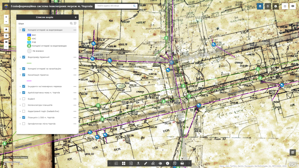
The structure of the layers of the Geoinformation System of Engineering Networks:

  • a subsystem for visualization of a digital map of engineering networks in combination with cartographic services (Google Maps, Bing Maps, Open Street Map, etc.), urban planning (general plan, digital topographic plan, orthophoto plan, etc.), and land management documentation;
  • subsystem of the register of addresses, streets (a layer of buildings with additional information: type, material, number of floors, etc.) and other named objects;
  • a subsystem for monitoring emergency situations and keeping a history of incidents on networks;
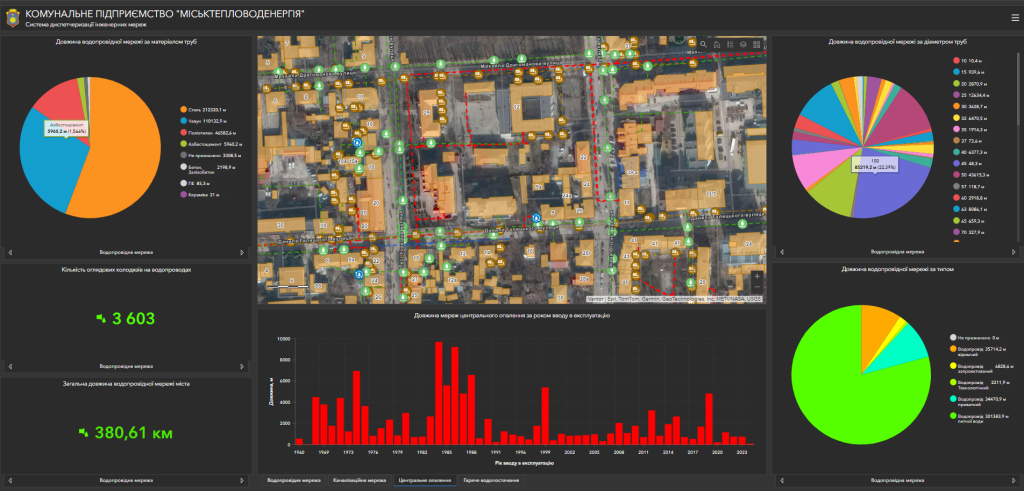
  • a subsystem of operational dispatch monitoring of the state of engineering networks as a consolidated information panel (dashboard);
  • a subsystem for keeping records of inspection wells and their technical characteristics (belonging to the type of networks, depth, exact coordinates, etc.);
  • relevant security zones with an indication of the nature of the restrictions.

Cost and terms of execution

MagneticOne Municipal Technologies provides a full range of services related to the development of a geoinformation system of engineering networks, namely the supply, installation and configuration of hardware and software, scanning and vectorization of paper diagrams of engineering networks and the implementation of field engineering and geodetic searches for filling GIS data, training specialists, technical support and support of the geoinformation system. Development terms are agreed upon additionally.

Services that precede the creation of GIS

  • Консультування
  • Сканування паперових документів та карт
  • Просторова прив'язка картографічних матеріалів
  • Оцифрування
  • Наповнення бази даних ГІС