
In 2026, work with Ukraine’s State-Level Urban Planning Cadastre is moving from obtaining access to the practical task of filling the system with reliable geospatial data. As of March 2026, 1,302 territorial communities — 99% of all communities, excluding areas affected by hostilities or temporary occupation — had received the authority to commission urban planning documentation in the system.
Access alone does not make a community ready for full-scale digital planning. It must inventory its materials, verify coordinates and attributes, organise a geodatabase, and assign responsibility for keeping the information current. This guide provides a practical route from scattered files to a manageable digital resource.
What changed in 2026
The State-Level Urban Planning Cadastre is becoming a shared digital environment for spatial planning and recovery. According to the official Cadastre portal, almost all communities have already received the authority to commission urban planning documentation. In June 2026, the system also introduced functionality for uploading regional spatial planning schemes.
The main practical challenge for local authorities is therefore data quality and interoperability. Documentation should not merely exist as a scan or a file on a local computer. It must be prepared as structured geospatial data that can be checked, updated, and reused.
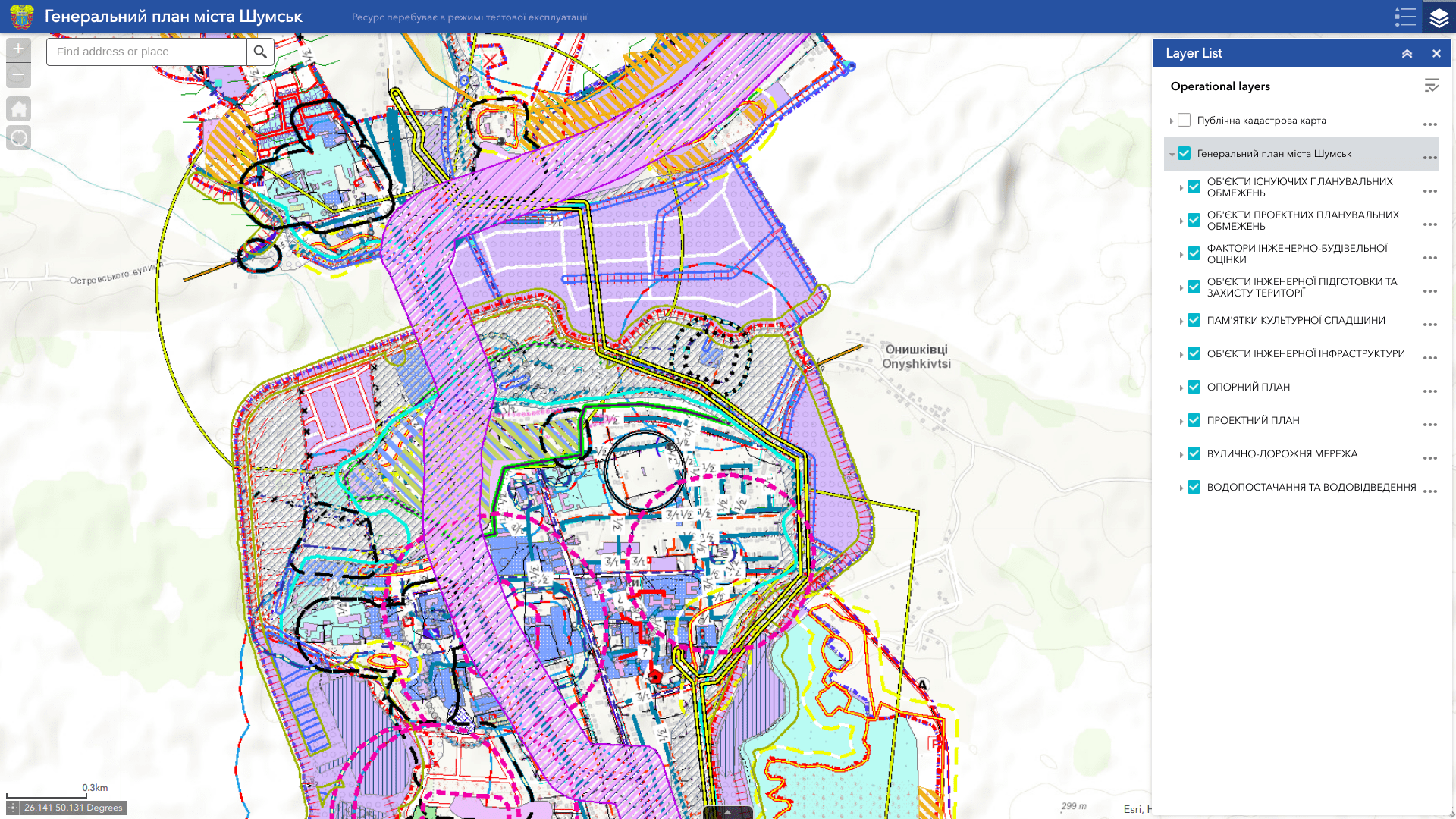
What data should be prepared
The exact scope depends on the type of planning documentation and the community’s objectives. The initial inventory should cover at least:
- approved urban planning documentation and the decisions approving it;
- vector layers, raster plans, topographic base maps, and orthophotos;
- community and settlement boundaries, functional and planning zones;
- land parcels, land-use restrictions, and protection zones, subject to information-access rules;
- engineering, transport, and social infrastructure;
- metadata describing the source, creation date, coordinate system, responsible department, and currency status.
Ukrainian requirements provide for digital geospatial data linked to the USK-2000 coordinate system and organised according to defined classifiers and geodatabase structures. In practical terms, a community must verify geometry, attributes, and consistency between layers before submission.
Where materials exist in different formats or were created in different years, begin with the digitisation of urban planning documentation and conversion to a common structure.
Five practical steps for a community
- Inventory the materials. Create a register of documents, files, maps, and datasets, recording their format, date, and responsible department.
- Confirm legal status. Separate approved documentation from drafts, working materials, and references. Check that approval decisions are available.
- Check technical quality. Identify duplicates, geometry gaps, missing attributes, incorrect coordinate systems, and contradictions between layers.
- Build the geodatabase. Bring objects into the required structure, classification, and formats. Add metadata and record the source of each dataset.
- Establish continuous updating. Assign responsible staff, define change procedures, and keep an update log after submission to the State Cadastre.
Common preparation errors
- Uploading without validation. Errors in source materials are transferred to the state system and become harder to correct.
- Confusing scans with geospatial data. A scanned plan can be useful as a reference but cannot replace structured vector objects with attributes.
- Missing metadata. Without source, date, and ownership information, the reliability of a dataset cannot be assessed.
- Mixed coordinate systems. Individually correct layers can still be displaced relative to each other.
- One-off delivery without an update process. Data quickly loses value if no one is responsible for maintaining it.
Why a community needs its own operational GIS
The State Cadastre is the environment for official urban planning documentation. For everyday management, a community often needs its own tool for combining authorised data from different departments, maintaining working layers, performing spatial analysis, and preparing updates.
A municipal urban planning cadastre geoportal provides that environment: controlled staff access, map-to-document links, and an understandable updating process.
What a good result looks like
The outcome should not be a folder of files prepared for a one-time upload, but a managed information resource with:
- a clear inventory and structure for all available data;
- verified geometry, attributes, coordinates, and metadata;
- a distinction between official, working, and reference materials;
- assigned responsibilities and a regular update procedure;
- data ready for spatial planning, recovery, and evidence-based decisions.
With experience from more than 300 projects at national, regional, municipal, and organisational levels, MagneticOne Municipal Technologies can assess source materials and develop a practical implementation sequence without unnecessary duplication.
Would you like to assess your community’s data readiness?
Send us a brief description of the materials you have. We will help identify what is ready, what needs validation or digitisation, and the most practical place to begin.