
Creation of a comprehensive plan for the spatial development of the territory of the community

Spatial development of the community

A comprehensive plan that integrates territory, data and future solutions

MagneticOne Municipal Technologies, together with specialized partners, ensures the creation of a comprehensive plan for the spatial development of the community territory — from the preparation of initial data to digital documentation and a geoinformation base.
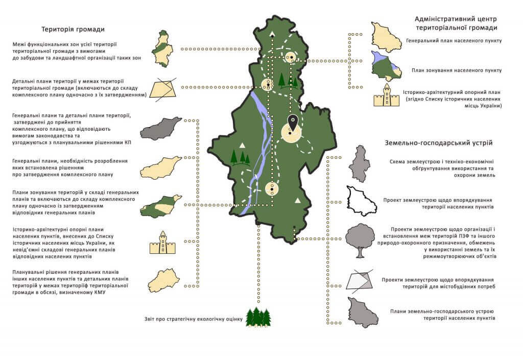
КППР території територіальної громади 1024x697 1

Single documentation

What defines a comprehensive plan

01

Planning organization

Functional designation of territories, development of settlements and sequence of implementation of decisions.

02

Infrastructure

Road network, public service, engineering and transport infrastructure and landscaping.

03

Safety and environment

Civil defense, protection of land, natural environment, ecosystem and cultural heritage.

The comprehensive plan is both urban planning documentation at the local level and land management documentation. Regulatory basis:Law of Ukraine No. 711-IX.

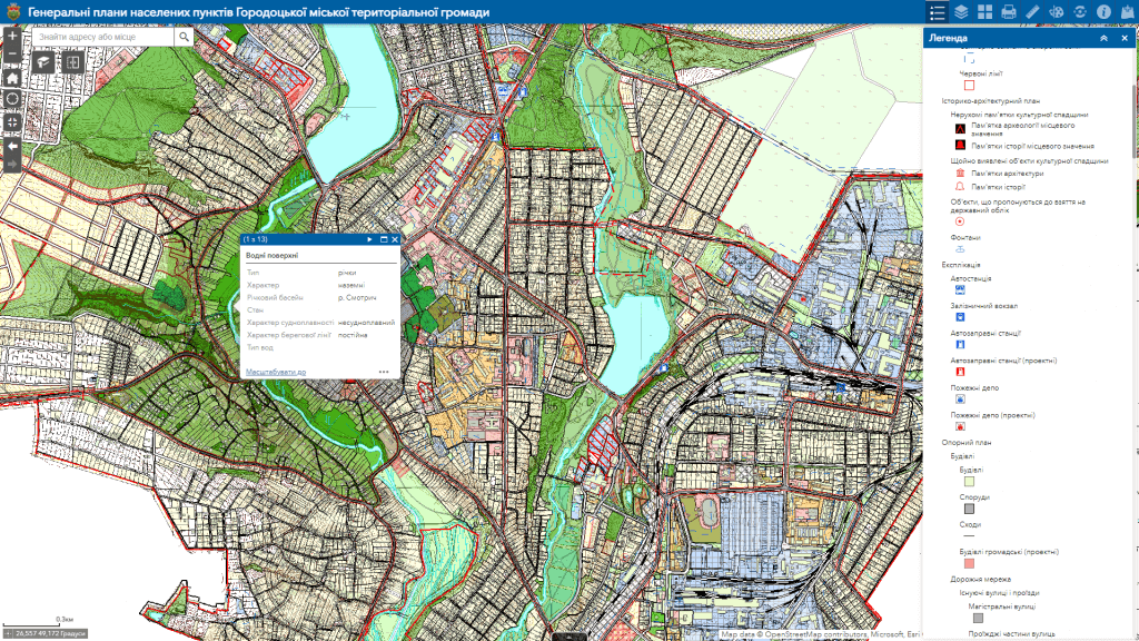
ГІС Городоцької громади

A holistic vision

Coordinated development of the entire territory of the community

The comprehensive plan combines decisions regarding the administrative center, other settlements and territories beyond their borders. This creates a unified basis for land use, development, infrastructure projects and investments.

  • coordination of current urban planning documentation;
  • definition of functional zones and requirements for development;
  • integration of land, topographic and urban planning data;
  • formation of a transparent digital basis for management decisions.

Composition of documentation

What can be included in a comprehensive plan

Urban planning part

  • general plan of the administrative center of the community;
  • master plans of other settlements;
  • detailed plans of territories;
  • boundaries of functional zones and requirements for their development;
  • historical and architectural reference plans — if necessary.

Land management and geospatial part

  • materials of topographical and geodetic surveys;
  • explication of land plots;
  • information about owners, users and restrictions;
  • land distribution plans by categories and areas;
  • formation of land plots of communal property.

Organization of works

Sequential process from data to approval

1Task analysis

We clarify the goals of the community, the territory, the available documents and the expected result.

2Data preparation

We collect, check, scan, coordinate and structure source materials.

3Development of solutions

We form planning, land management and geospatial components of documentation.

4Digital integration

We are preparing data for further use in GIS and urban cadastre.

The beginning of cooperation

We will evaluate the source materials and propose a work plan

The scope, terms and team of the project depend on the area of ​​the community, the state of the documentation and the composition of the necessary decisions. Let’s start with a short consultation.