
Geoinformation management system of the cottage town –is a modern cartographic web resource designed to save, accumulate and display information about the cottage town. The system includes a control panel for data sets (buildings, land plots, engineering networks, etc.), individual map resources, layers of spatial information. The deployment of the system includes supplying the customer with hardware and software, filling databases, training specialists to keep the system up to date, technical support of the geoinformation system.
Geoinformation management system of a cottage town
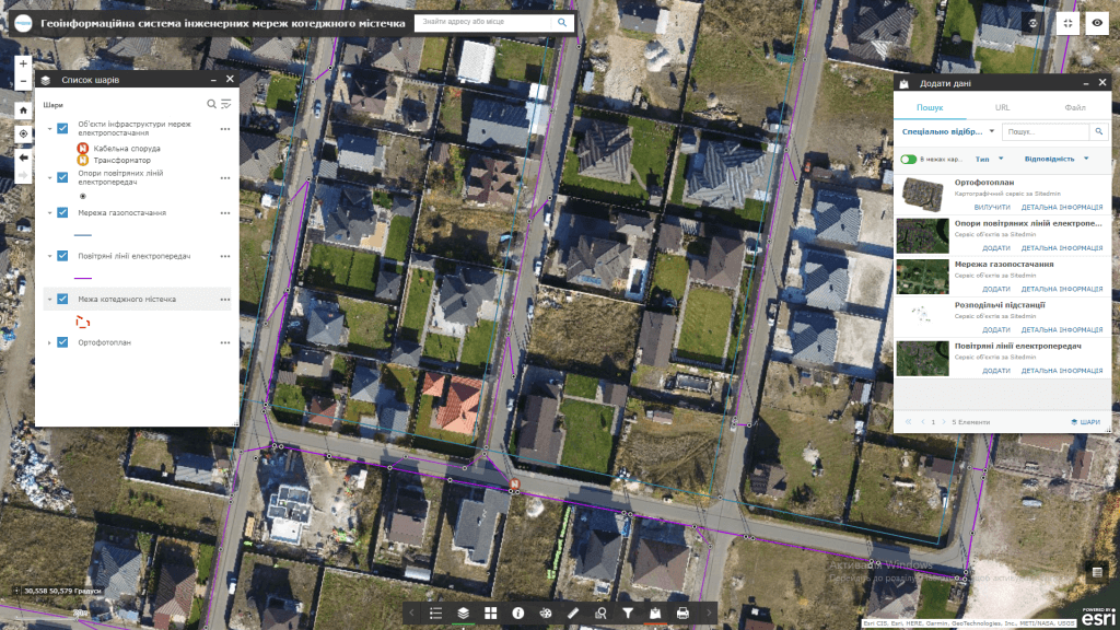
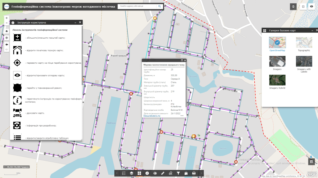
GIS capabilities of the cottage town:
- visualization on an interactive map of objects of the cottage town (buildings and structures, engineering networks, land plots, etc.) and their detailed technical parameters (diameter and material of pipes, dates of commissioning and last repair, number of cables, voltage, etc.);
- connection to a set of display of space images, orthophoto plans, urban planning documentation, raster diagrams of engineering networks, etc.;
- execution of spatial and attributive queries, the possibility of searching, group editing of data;
- provision of operational inventory of objects in real time using mobile devices;
- implementation of public electronic appeals and registration of incidents by citizens (emergency service call, pipe burst, etc.) using mobile devices.
Geoinformation system modules:
- subsystemreal estate and construction management– the subsystem is designed to automate the activities of specialists in the field of planning and design in the process of building a cottage town (keeping records of construction stages, automatic updating of orthophoto plans with a given frequency, maintaining the next town development plan, topographic plans, etc.);
- information management subsystem (integration of information between the geoinformation system and accounting systems (including BAS KUP, 1C accounting);
- subsystemmanagement of engineering networks – the module is designed to save, accumulate and display information about the engineering infrastructure of the cottage town (sewage and heating networks; underground water pipes, gas pipelines; overhead power lines, communication cables, power cables; inspection wells, etc.). The module includes an informational component – visualization in raster and vector formats of schemes of engineering networks, as well as calculation – implementation of complex hydraulic calculations;
- video surveillance management subsystem with information output on the dashboard (information panel);
- subsystemmanagement of the land fundcottage town – the module allowsuse data from state registers, open sources and local cartographic materials to visualize and form analytics about the land fund of the town in terms of land plots, their owners and users. The module contains information about the owners of land plots, their purpose, status, etc. The module ensures the automation of the land cadastre of the town in the mode of combining with the data of the State Land Cadastre, the State Register of Real Property Rights, the Register of Court Decisions, and tax registers.
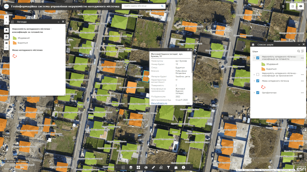
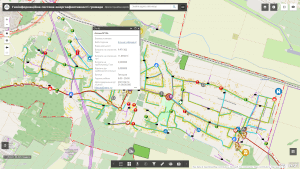
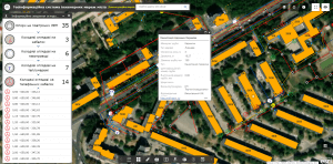
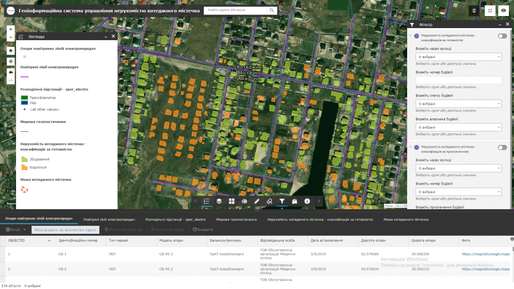
A set of layers of the geographic information system:
- border of a cottage town;
- single address register: streets, buildings and their parts;
- land plots with the possibility of automatic updating of data from state registers;
- engineering networks (water supply, fire-fighting water supply, drainage, sewerage, gas pipelines, electricity supply, outdoor lighting networks, heating, low-current networks and corresponding inspection wells);
- security systems (video surveillance, checkpoints, switching points, etc.);
- transport routes and highways (entrances, internal, sidewalks, maintenance, information about repairs);
- socio-cultural and sports facilities, playgrounds, green spaces, park areas, water resources, etc.
Requirements, cost and terms of order fulfillment:
MagneticOne Municipal Technologies provides a full range of services related to the development of a geoinformation system of engineering networks, namely the supply, installation and configuration of hardware and software, scanning and vectorization of paper diagrams of engineering networks, and the implementation of real-time engineering and geodetic searches for filling GIS data, training specialists, technical support and support of the geoinformation system. Development terms are agreed upon additionally.