
- The situation with the accounting of mined land plots on the territory of Ukraine is characterized by the fact that almost no source provides comprehensive and reliable information about this problem. In particular, it creates a big obstacle for farmers who work in areas where hostilities took place.The lack of reliable information on possible suspected minefields or mined areas poses a real national level threat to the safety of workers and can lead to serious economic losses, especially in agriculture.
- Therefore, the development and implementation of the Analytical System of Demining Management becomes a critically important task at the national level.
- Analytical system of demining management at the national level– is a modern cartographic resource that contains a system of tools for recording mined territories at the state level. The product is designed to provide state authorities, local governments, law enforcement agencies, international bodies, legal entities and individuals working in the fields of security, defense, industry, agriculture, etc., with reliable information about the state of a specific territory.
Analytical system of demining management at the national level
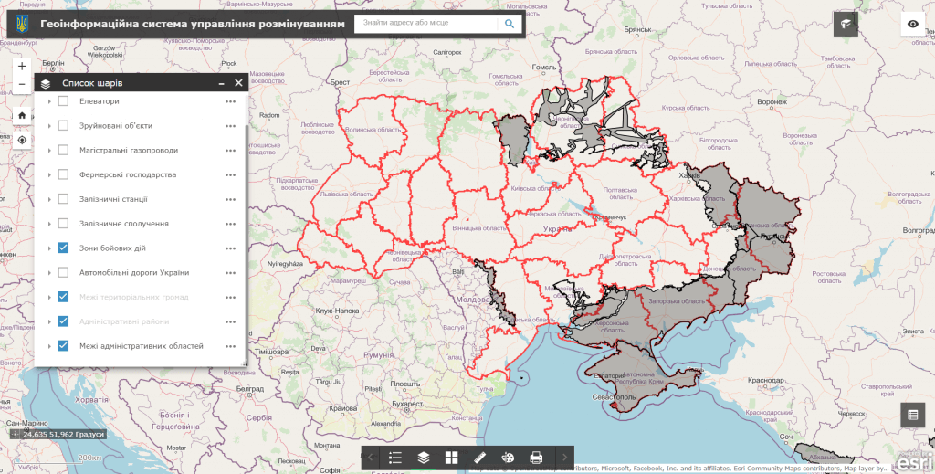
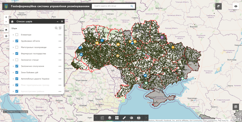
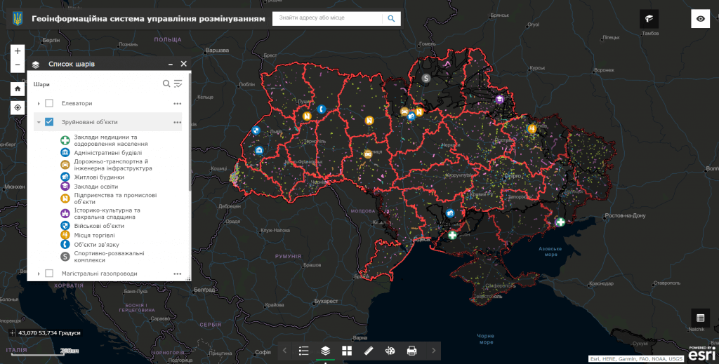
Capabilities of the analytical system:
- an intuitive system for recording and conducting audits of mined areas in real time on an electronic map;
- the user does not need special software to work, it is enough to have a web browser and an Internet connection;
- the possibility, in addition to textual descriptions, to record a photo report of the mined territory, to transmit its exact coordinates;
- round-the-clock possibility of fixation, constant readiness of the resource for work;
- the ability to process large volumes of object audits, collect data on mined areas and monitor their demining;
- regulated access to information resources thanks to the assignment of roles to system users (administrator, operator, editor);
- operational search for explosive objects in designated agricultural areas within the framework of ensuring the food security of the state;
- the use of unmanned aerial vehicles (drones) with a magnetometer to detect metal objects, including mines and explosive devices;
- processing and analysis of data received from magnetometers to create maps of magnetic anomalies.
- the possibility to inform about the demining of the territory through the feedback form.
Advantages of using an analytical system for national level management:
- automation of recording, accounting and subsequent demining of the territory by implementing electronic services for registration and exchange of spatial information;
- visualization of the actual state of the land on an electronic map;
- operational access, administration and updating of information on the progress of works on fixing mined areas.
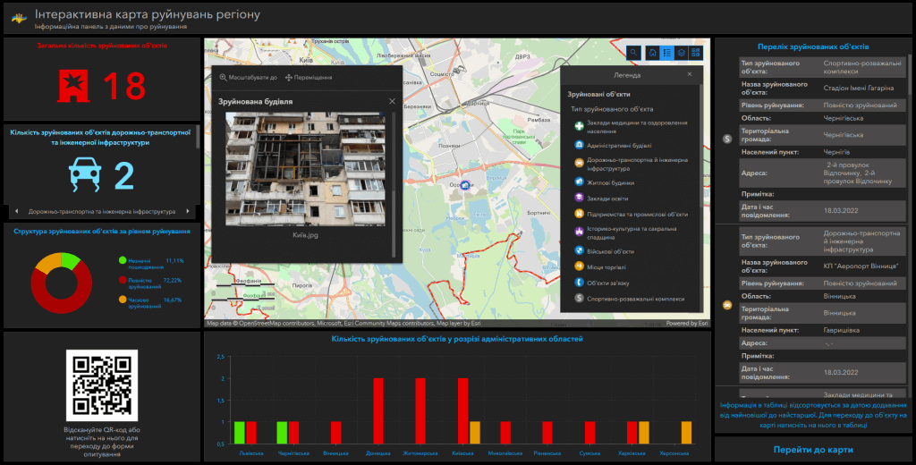
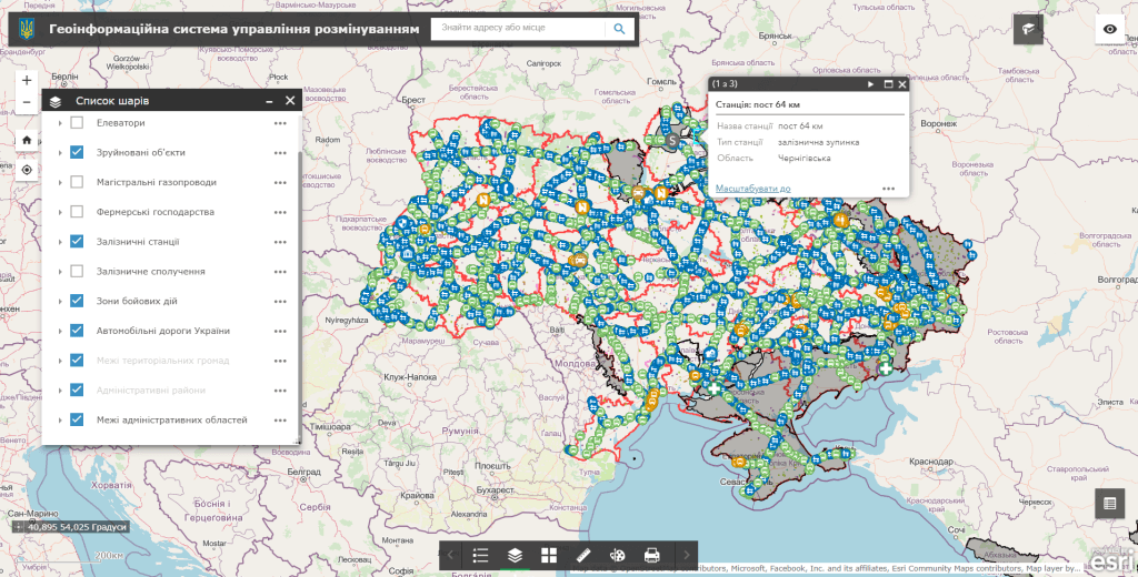
Analytical system data set:
- geographical boundaries of administrative regions of Ukraine;
- geographical boundaries of administrative communities operating on the territory of Ukraine;
- satellite images of the area in the pre-war period (images of the area obtained from satellites before the start of the war);
- graphic representation of the relief of land plots that can be mined;
- information about objects on which mines may be installed, including bridges, buildings and other objects;
- geographical data on areas where hostilities are taking place;
- information about territories where demining has already been carried out and the absence of mines has been established.
Modules of the analytical system:
- a subsystem for visualizing an electronic map of mined territories in combination with popular cartographic resources (Google Maps, OpenStreetMap);
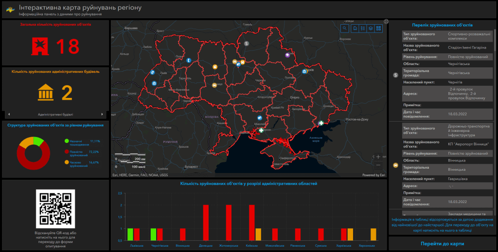
- a visualization subsystem of mined areas as an information panel (dashboard).
The cost and thatroomand order fulfillment
- MagneticOne Municipal Technologies provides a full range of services related to the development of a national level Analytical Management System for demining, namely supply, installation and configuration of hardware and software, data map filling, specialist training, technical support and analytical system support. Development terms are agreed upon additionally.
Next step
Let us discuss an analytical system for your objectives
We will clarify users, data sources, required modules, integrations and delivery format, then propose a clear implementation plan.