Geoinformation system of community energy efficiency– modulegeographic information system of the territorial community, which provides collection, processing and visualization of energy data, modeling, forecasting of energy efficiency management processes, and support for making management decisions aimed at increasing the energy efficiency of the community economy. The software complex provides the user with a wide set of tools for creating, filling and editing electronic maps, performing calculations in the field of energy efficiency, developing work organization plans for the implementation of energy-efficient measures, creating route maps for the maintenance of communally owned objects of the community by bypass method.
Geoinformation system of community energy efficiency
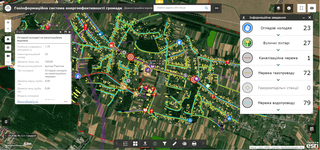
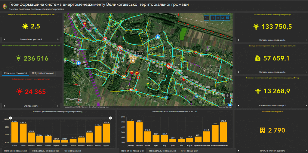
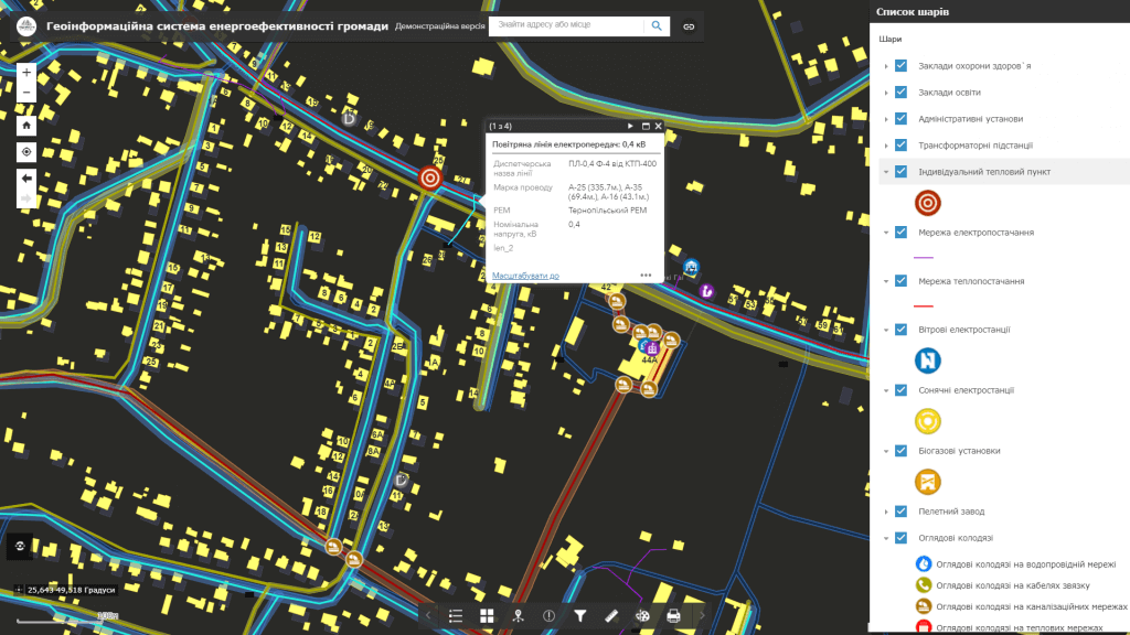
Capabilities of the geoinformation system:
- the modular architecture of the software allows for the gradual implementation of local community energy efficiency programs;
- deployment of the system includes supplying the customer with hardware and software, filling databases, training specialists to keep the system up-to-date, technical support;
- the software has an intuitive interface, the software is built on the basis of modern geo-information technologies;
- system support does not require programming knowledge, there is no need to keep programmers in the customer’s staff;
- the system interface includes a control panel for data sets, separate map resources, layers of spatial information, etc.;
- regulated access to information resources thanks to the assignment of roles to system users (administrator, operator, editor);
- connection to a set of display of space images, orthophoto plans, urban planning documentation, raster schemes, etc.;
- execution of spatial and attributive queries, the possibility of searching, group editing of data.
Use a wide range of GIS analytical capabilities:
- collection and storage of energy data of transport enterprises, industry and housing and communal services of the community in real time;
- processing and visualization of energy data in terms of enterprises and communities;
- information interaction and quick access to energy data of community enterprises;
- analysis of the dynamics and structure of energy consumption of enterprises and the community;
- analysis of the dynamics of changes in the energy efficiency of individual objects and the community as a whole;
- modeling and forecasting of the energy efficiency of enterprises and the economy of the community;
- operational control of energy consumption and detection of losses of energy carriers.
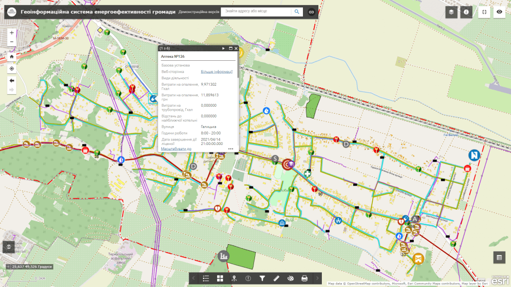
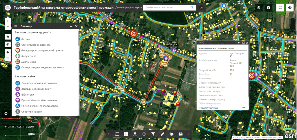
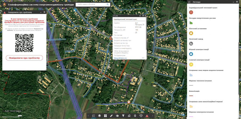
The structure of the layers of the geographic information system:
- electronic map visualization subsystem of objects of electricity consumption (enterprises of transport, industry, housing and communal services), objects of energy production (solar and wind power plants) and energy transportation (engineering networks) in the mode of combining with mapping services (Google Maps, Open Street Map, etc.),city planningandland managementdocumentation;
- subsystemimplementation of operational inventory (energy audits) of enterprises and communal property objects in real time using mobile devices;
- a subsystem for making public electronic appeals and registering incidents by citizens (emergency service calls, pipe bursts, etc.) using mobile devices;
- a visualization subsystem of the main indicators of community energy management as a consolidated information panel (dashboard).
Cost and terms of order fulfillment
MagneticOne Municipal Technologies provides a full range of services related to the development of a community energy efficiency geo-information system, namely the supply, installation and configuration of hardware and software, scanning and vectorization of paper documents and field surveys (energy audits) of filling GIS data, specialist training, technical support and support of the geo-information system. The terms of development of the geoinformation system are agreed upon additionally.
Services that precede the creation of a geoinformation system:
- Consulting
- Scanning maps and documents
- Georeferencing cartographic materials
- Digitization
- Geospatial database population