
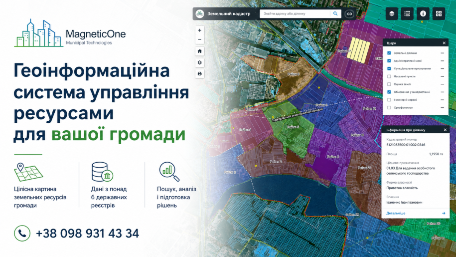
Information about a community’s land resources is often scattered across the State Land Cadastre, registers, spreadsheets, documents, land-management files, and local databases. A land management GIS brings the available information into one operational environment and displays it on a shared map.
GIS does not replace the State Land Cadastre
The State Land Cadastre is the official source of information about land parcels, including cadastral numbers, areas, boundaries, and designated use. A municipal GIS does not change official records. It helps authorised staff compare available information, add internal working data, and analyse parcels in the context of the entire territory.
What data can be used
The composition depends on the community’s objectives and the materials legally available to it. The system may include:
- community, settlement, and administrative boundaries;
- parcels, cadastral numbers, areas, designated use, and ownership categories;
- leases, expiry dates, valuation information, and related documents;
- municipal property and internal working records;
- land-management and cartographic materials;
- nature protection areas, water-protection zones, and other relevant restrictions;
- notes, review statuses, and thematic layers created by municipal specialists.
Completeness and currency always depend on the source datasets and the information provided for implementation.
How specialists use the GIS
- search for parcels by cadastral number, address, or attributes;
- view characteristics, documents, leases, and working notes;
- filter municipal land, expiring leases, or records requiring clarification;
- compare documents with objects shown on the map;
- create thematic layers and internal control statuses;
- prepare maps, selections, and summaries for management and committees.
A dashboard can present consolidated indicators such as land area, ownership structure, designated use, and lease information without repeated manual work in spreadsheets.
One map for connected municipal tasks
Land data becomes more useful when compared with urban planning objects, municipal property, utility networks, and protected areas. This makes it easier to identify spatial overlaps, inconsistencies, missing records, and territories requiring additional review.
A community can begin with the most urgent module and expand the GIS gradually. Staff training, practical instructions, and an agreed updating process are essential parts of implementation.
What the community receives
- a single working map for available land data;
- faster search and comparison of information;
- controlled access for responsible staff;
- a clearer picture of the whole land portfolio;
- a basis for audits, planning, and evidence-based decisions.
Would you like to assess your community’s land data?
We can review the available materials, demonstrate relevant GIS functions, and outline a practical implementation sequence.