Geoinformation system (GIS) management of cultural heritage objects– modulegeoinformation system of the community, the main task of which is to ensure the implementation of state and regional policy in the field of protection, preservation and use of cultural heritage objects by means of their registration, accounting, storage, visualization and spatial analysis by means of geo-information technologies. The geoinformation system serves as a tool for improving state management in terms of accounting and registration of cultural heritage objects, and provides unimpeded access for a wide range of users to the public part of information about immovable landmarks of the region.
Geoinformation system for managing cultural heritage objects
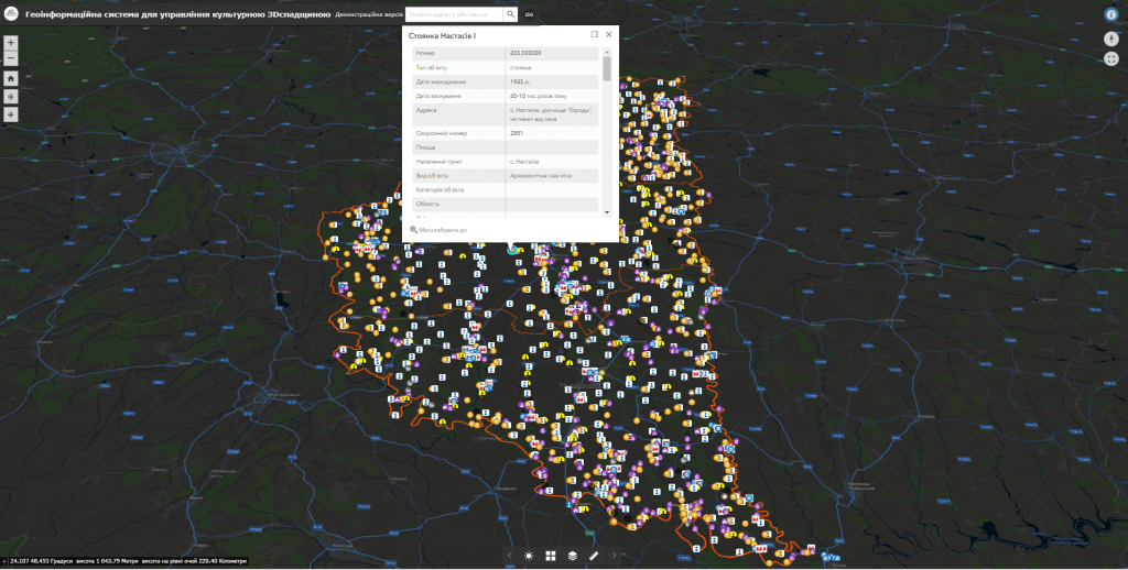
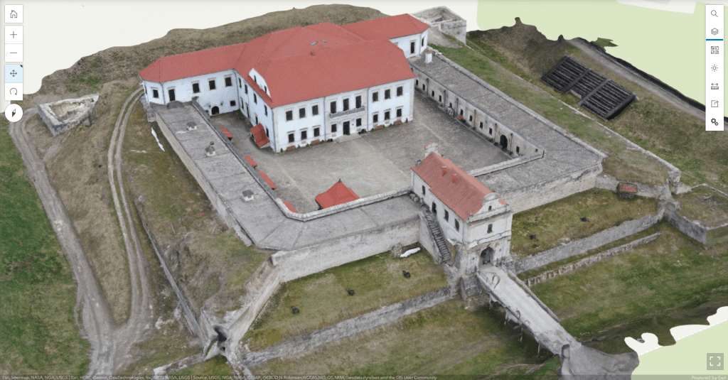
Geoinformation system modules:
- subsystem of visualization of cultural heritage objects on an interactive map;
- subsystem for keeping records of electronic passports of cultural heritage objects;
- a subsystem of operational inventory (audit) of cultural heritage objects using mobile devices in real time;
- subsystem of monitoring the state of cultural heritage objects by means of mobile devices;
- a module for electronic appeals from citizens regarding the detection of violations in the field of monument protection activities;
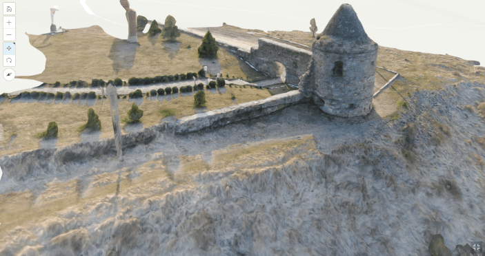
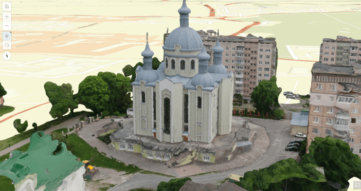
- subsystem of visualization of cultural heritage objects in 3D format.
Capabilities of the geoinformation system:
- visualization, operational access, administration and updating of information about cultural heritage objects of the region;
- operational inventory of objects of cultural heritage (archaeological, historical, monumental art, architecture and urban planning, garden and park art, landscape) for the purpose of rapid response to various threats to them and their preservation;
- automation of keeping records of passports of cultural heritage objects with the possibility of placing additional information about cultural heritage objects (photos, diagrams, descriptions, scanned copies of documents, etc.);
- automation of maintenance and recording of documentation provided for by the Procedure for Accounting of Cultural Heritage Objects, namely Acts of State of Preservation, Acts of Visual Inspection, Acts of Inspection of the Landmark and its Territory, etc.;
- ensuring the maintenance of unified electronic records of existing cultural heritage objects, determining the areas of their protection zones;
- determination of planning restrictions taking into account the protection zones of cultural heritage objects and the requirements of urban planning documentation at the regional and local levels;
- visualization of cultural heritage objects in combination with popular cartographic services (Google Maps, Open Street Maps), state (State Land Cadastre) and regional (town planning) cadastres, etc.;
- provision of information exchange and constant updating of information necessary for coordination and decision-making on issues of socio-economic, cultural or urban planning policy, etc.
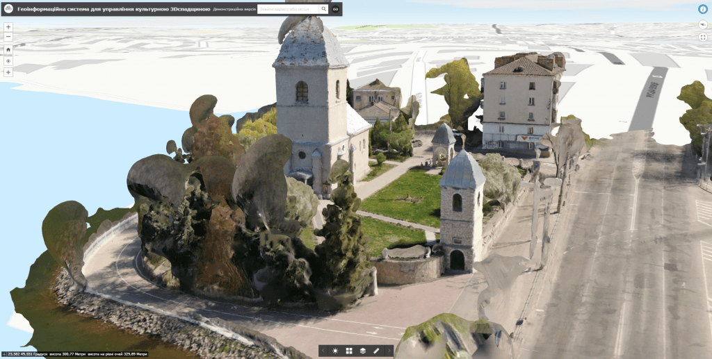
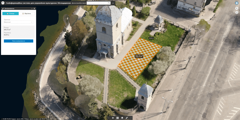
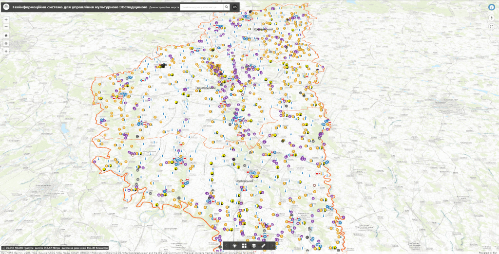
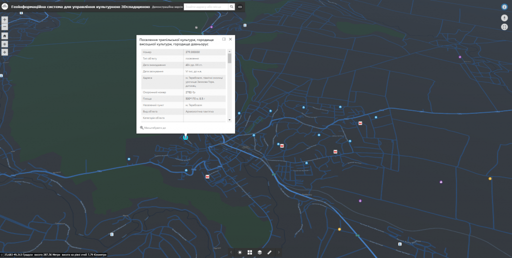
A set of layers of the Geoinformation System:
- modern administrative-territorial division (borders of oblasts, districts, communities, settlements);
- monuments of cultural heritage of national and local importance (monuments of archaeology, history, monumental art, architecture and urban planning, garden and park art, landscape, science and technology);
- UNESCO world heritage sites;
- historical and cultural reserves;
- monument protection infrastructure (monument protection information boards);
- protection zones of cultural heritage objects and others.
GIS implementation services:
- purchase, supply and installation of server and computer equipment;
- purchase, installation, configuration of software;
- filling databases of the geoinformation system with relevant materials, putting the system into operation;
- training of the Customer’s representatives to work with the geographic information system;
- maintenance / support of the geoinformation system.
Cost, requirements and deadlines for order fulfillment
MagneticOne Municipal Technologies provides a full range of services related to the development of a geo-information system for the management of cultural heritage objects, namely the supply, installation and configuration of hardware and software, GIS data filling, training of specialists, technical support and support of the geo-information system. Development terms are agreed upon additionally.
Tell us about your project and our specialists will suggest the appropriate implementation format.
Services that precede the introduction of the card
- Consulting
- Scanning maps and documents
- Georeferencing cartographic materials
- Digitization
- Populating the interactive map database