M1MT: Interactive map of territorial community

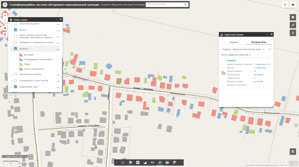
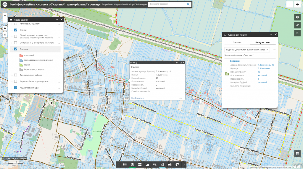
M1MT: Interactive map of territorial community – is an innovative solution developed by experts in cartography, the main task of which is to provide stable and comfortable management of land resources. Thanks to its flexible database, the electronic map is the most effective means for arranging a large amount of land use and cadastral information so it may substitute more than ten paper maps.

Functionalities of the map

  • the fullest set of functions: map navigation, data editing, vector map layers management, spatial analysis, address search;
  • for its operation the user does not need any specialized software or qualification of a cartographer – a web browser and an Internet connection would be enough;
  • ease of search, quick update and database editing;
  • constant operational readiness;
  • protection of information from distortion and unauthorized access;
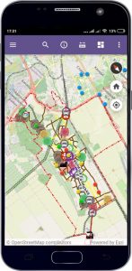
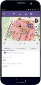
  • managing vital community processes by means of a mobile phone;
  • control and quality evaluation of services provided by operation staff and remote (mobile) workers (inspectors, auditors, land surveyors, social workers) by the management of the United Territorial Communities;
  • monitoring and processing of citizens’ queries by means of an electronic query system.
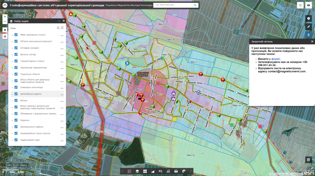
Геоінформаційна система територіальної громади

M1MT: Interactive map of territorial community is an effective tool for taking reasonable decisions

  • get information support and operational access to the spatial database and necessary land management materials;
  • keep up-to-date data on the administrative, household and industrial infrastructure of the rural area (in layers are represented cultural and educational, medical and other institutions, etc.);
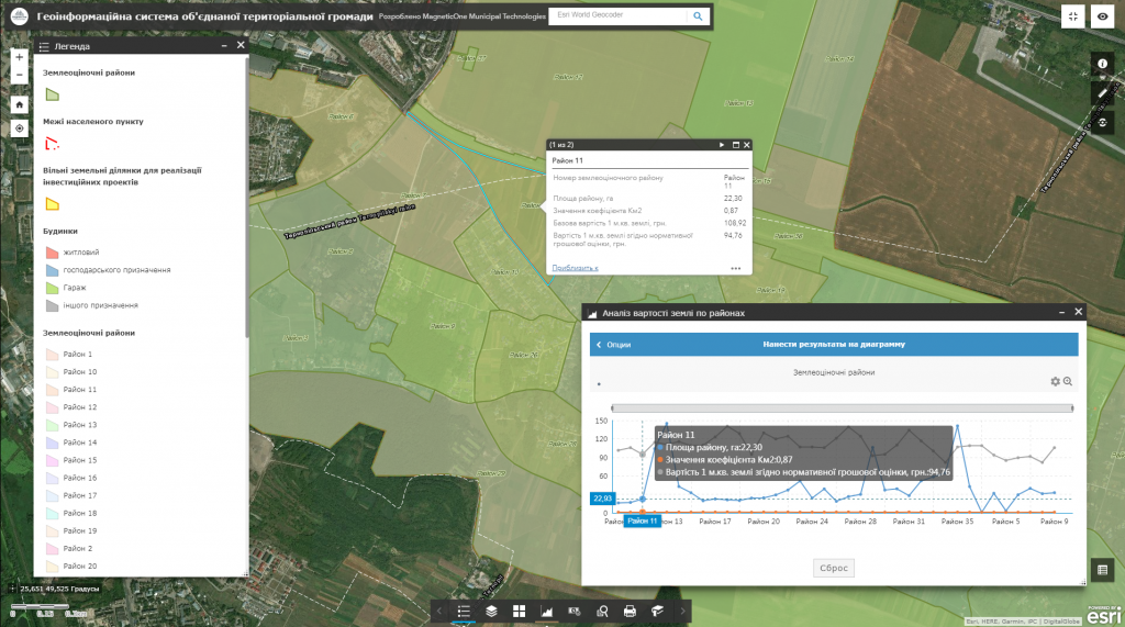
  • determine the value of land plots and amount of land tax by means of normative monetary valuation electronic map;
  • facilitate and increase the efficiency of the decision-making process in the field of agriculture and construction (selection of land plot for transfer of the ownership, for residential development, etc.);
  • plan maintenance and repair of roads and administrative buildings (the interactive map contains information about the planned repair of roads and buildings, its costs, etc.);
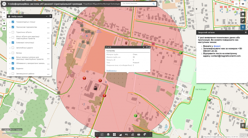
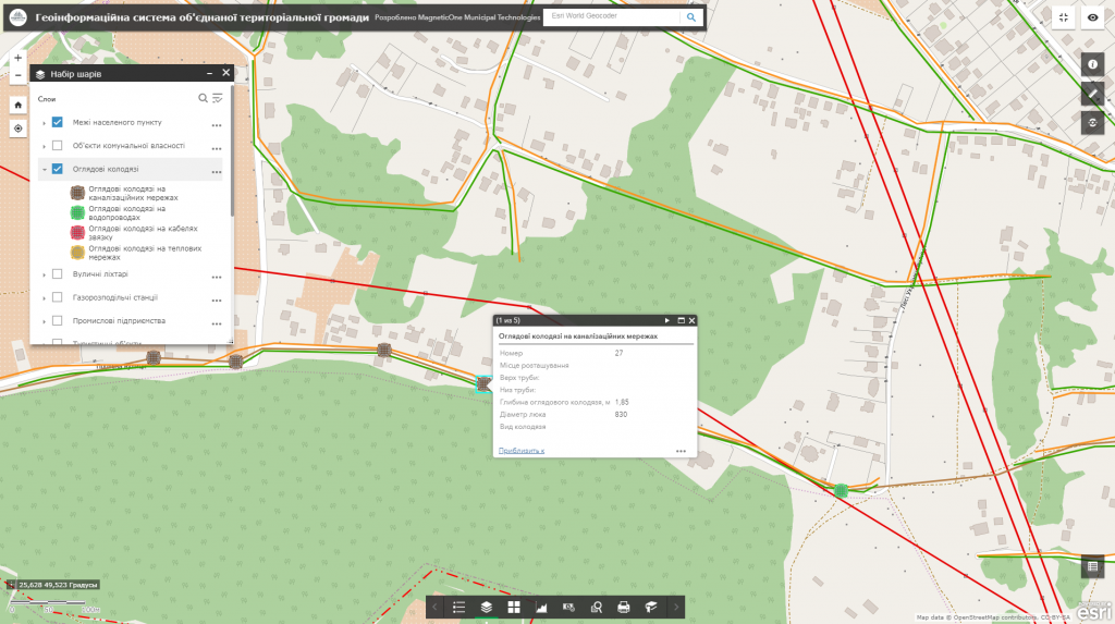
  • keep a record of engineering communications, prevent emergencies (the map displays underground engineering communications with the indication of their technical parameters);
  • observe restrictions on land usage (the map visualizes water protection, sanitary protection and other protected areas);
  • get maximum work efficiency by using vector territory formation maps, cartograms of agro-industrial groups of soils, normative monetary valuation, etc.;
  • get an objective assessment of the state of the land resources, improve the land registry system. The advanced map functionality displays information on land distribution by owners, forms of ownership, users, lands;
  • get current data on the soil (the content of humus, granulometric composition, etc.), plan agrotechnical and soil protection measures wisely;
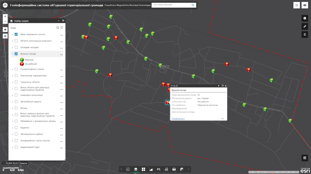
  • control the quality of works performed by utility services through a system of electronic queries providing the ability to form photo reports, send location data to employees in real time;
  • monitor adverse physical and geographical processes: development of ravines, snow drifts (snow blockades), flooding, especially dangerous sections of roads (highways, bridges), etc.

An approximate set of thematic layers of the interactive map

  • boundaries (of the territorial community, village councils, and settlements);
  • land valuation areas (with the indication of their area, Km2 coefficient, benchmark price, and land value subject to normative monetary valuation);
  • soil suitability classification (a type of soil and its properties);
  • engineering communications: power lines, gas pipelines, water pipes, sewage and heating networks, underground cables and inspection wells for their maintenance, indicating their type, technical characteristics (material and diameter of pipes, depth of inspection wells, etc.);
  • restrictions on land usage (around and along with the engineering networks, sanitary, sanitary and protective, water protection zones, etc.);
  • address directory of streets and buildings (street names, house numbers);
  • public housing development (administrative buildings, social and community infrastructure, industrial facilities, public transport stops, etc.);
  • investment objects and offers (free production areas, free land plots, investment projects);
  • tourist, historical and architectural as well as other objects;
  • a register of temporary constructions (small architectural forms), issued city-planning rules and restrictions, construction passports and other city-planning documents;
  • site plans, orthophotoplans and other cartographic materials (schemes, zoning plans, etc.) of settlements of the United Territorial Communities in distributive format.
Геоінформаційна система територіальної громади

List of materials necessary for basic interactive map functionality

  • normative monetary valuation of settlements that are part of a territorial community (schemes of economic planning zoning and exposure of local factors, cartograms of agro-industrial groups of soils);
  • projects on territory formation and establishment of village councils boundaries that are part of a territorial community;
  • cartograms of agro-industrial groups of soils;
  • schemes of settlements with the indication of engineering communications, street names, administrative and socio-cultural institutions;
  • site plans, orthophotoplans and other cartographic materials (schemes, zoning plans, etc.) of settlements that are part of the United Territorial Community.

Cost and terms of performance

Calculation of the cost of interactive map development will depend on the number of thematic layers of the map, branching of the database, as well as the individual requests of the customer. The terms for web-map development will be up to 30-60 days from the date of providing materials necessary for the development of the map and signing  a cooperation agreement.

Services which will be provided prior to implementation of the map

  • Consulting
  • Scanning of paper documents and maps
  • Georeferencing of cartographic materials
  • Digitization
  • Provisioning of interactive map database
Коротка інформація

[contact-form-7 id=”10714″ title=”Форма партнерства”]


×