Geoinformation system (GIS) of objects and territories of the nature reserve fund of the region

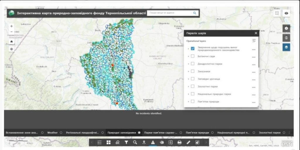
Geoinformation system (GIS) of objects and territories of the nature reserve fund– is a cartographic web product designed to save, accumulate and display information about the objects and territories of the nature reserve fund of a certain region. The geoinformation system is designed to ensure the efficiency and quality of work with spatial information about the nature reserve fund of the region, to provide public access to the information database of protected territories and objects, to provide information support to state bodies, interested enterprises, institutions and organizations with information necessary for solving issues of sustainable development.

The interactive map consists of a system of geographic data (spatial reference) and the territories of the nature reserve fund with numerous nature reserve objects, additional information about the territories and the possibility of getting to know these objects in detail.
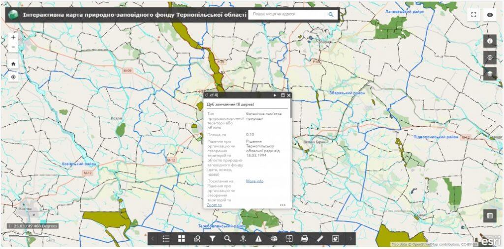
Opportunities of the Geoinformation system of objects and territories of the nature reserve fund of the region

  • display of objects and territories of the nature reserve fund of the region on any device connected to the Internet;
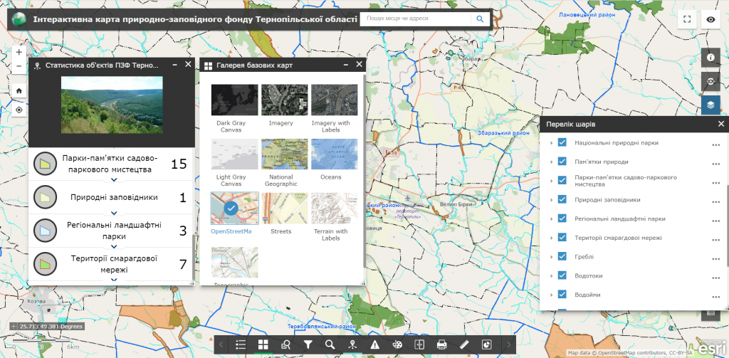
  • moving on the interactive map, changing the display scale;
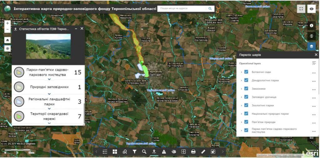
  • connection and disconnection to the display of data sets, space images;
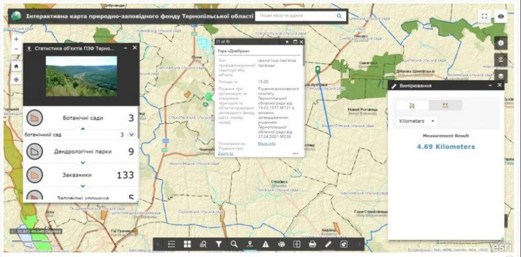
  • visualization of data and detailed background information on a separate object;
  • execution of spatial and attributive queries, the possibility of searching;
  • production of graphic (including cartographic) documents for information service of the population, local self-government bodies, organizations and institutions operating on the territory of the region;
  • recording of appeals from individuals and legal entities about violations of environmental legislation;
  • the possibility of group editing of data, constant readiness of the resource for work.

Use a wide range of analytical capabilities of the geoinformation system of objects and territories of the nature reserve fund of the region:

  • display the location of objects and territories of the nature reserve fund of the region and get access to detailed information about these objects;
  • provide the possibility of forming user requests;
  • analyze existing and plan potential objects of the nature reserve fund;
  • get immediate access to the administration and updating of digital and electronic maps and edit data in real time using a mobile application;
  • ensure access of state bodies and the public to information on environmental issues and the decision-making process;
  • manage access rights and control the actions of system users;
  • provide prompt notification of executive authorities about violations, submission of proposals and photo reports of the problem using the subsystem of public electronic appeals.

The set of layers of the geographic information system includes:

  • boundaries of the territory of the nature reserve fund;
  • objects of the nature reserve fund;
  • nature reserves;
  • national natural parks;
  • regional landscape parks;
  • sanctuaries;
  • natural attractions;
  • protected tracts;
  • botanical gardens;
  • dendrological and zoological parks,
  • natural attractions,
  • parks, attractions of garden and park art.

The cost and thatroomorder execution details:

MagneticOne Municipal Technologies provides a full range of services related to the development of a geographic information system, namely: supply, installation and configuration of hardware and software, filling the register with data, training of community specialists, technical support and support of the GIS module. The terms of development of the module are agreed upon additionally.

Services that precede the implementation of the geoinformation system:

  • Консультування
  • Сканування паперових документів та карт
  • Просторова прив'язка картографічних матеріалів
  • Оцифрування
  • Наповнення бази даних геоінформаційної системи