
Subsoil, value chains and resource security
From geological data to strategic planning of mineral resources
The platform combines deposits, licences, geological studies, infrastructure, processing and market connections to assess the resource base and develop sustainable supply chains.
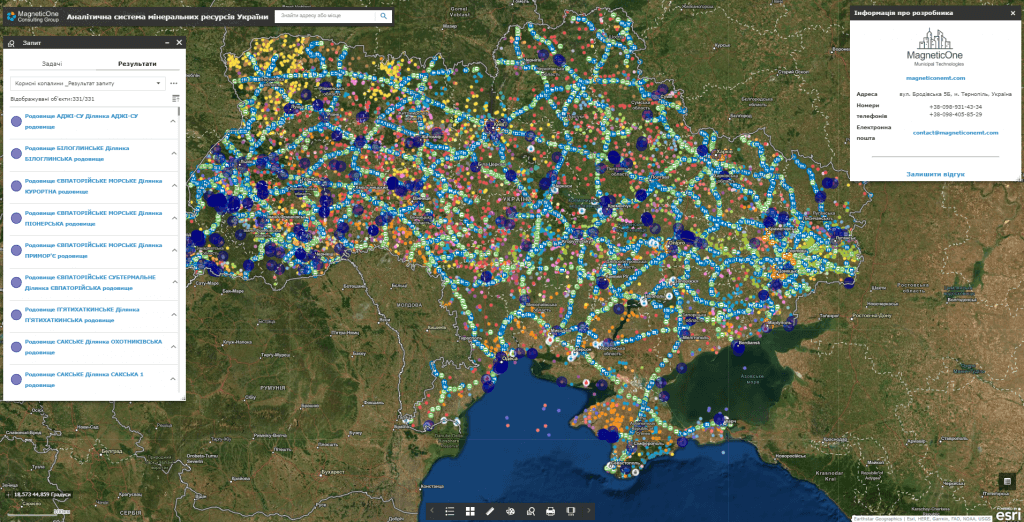
For which management decisions
Critical Minerals Intelligence supports public policy, regional planning and investment analysis by separating public and protected data loops.
Resource base
Territorial distribution of deposits, mineral occurrences, reserves, degree of study and statuses of subsoil use.
Development priorities
Comparison of sites according to geological, infrastructural, ecological and economic criteria.
Value chains
Linking mining to processing, materials production, logistics and downstream industries.
Resource security
Identification of critical dependencies, supply concentration and diversification opportunities.
What data does the system combine
The list of sources is determined during the discovery stage. The system can combine spatial, registry, statistical, documentary and operational data without public disclosure of information with limited access.
Geology
- deposits, occurrences and prospective areas
- stocks, resources and learning
- geological maps and research materials
Rights and statuses
- special permits
- subsoil areas and restrictions
- stages of preparation and development
Infrastructure
- energy, water and transport
- processing facilities
- industrial sites and logistics
Context
- nature protection and land restrictions
- settlements and social infrastructure
- market and technological chains
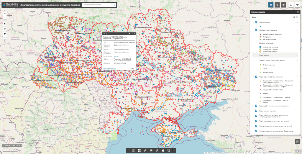
Key analytical modules
The analytics are built to separate verified facts from estimates and keep links to the source and date of each metric.
Mineral and raw material atlas
Interactive map of resources, geological study, rights of use and territorial restrictions.
Comparative assessment of sites
Multi-criteria comparison of prospective objects without replacing a professional geological assessment.
Map of value chains
Mining, beneficiation, processing, logistics, consumers and critical dependencies.
Investment profile
A structured view of verified data, infrastructure, statuses and next steps for a site.
How implementation works
We define management tasks, users, available data and access requirements.
We agree on classifiers, indicators, integrations, quality rules and updates.
We configure priority maps, panels, analysis scenarios and user roles.
We connect new territories, sources, modules, reporting and support.
Usage levels
Architecture can be formed for a national level, a ministry or public agency, a region, a municipality or an individual organization. Each level gets its own set of data, powers, indicators and reports.
National level
Strategy of critical raw materials and resource security.
Region
Resource base, infrastructure and industrial relations.
Municipality
Territorial limitations, impact and local infrastructure.
Organization
Portfolio of sites, research data and project readiness.
Related solutions and services
The platform can work as an independent analytical system or as an add-on to existing registers, geoportals and industry systems.