
Interactive map of the destruction of the region– is a modern online cartographic resource, which contains a system of tools for inventorying and accounting of residential, social and infrastructure objects destroyed by the occupation regime of the Russian Federation at the level of the region, community, and city. This interactive map of the destruction of the region is designed to provide state authorities, local governments, law enforcement agencies, international bodies, legal entities and individuals with reliable information about the physical condition of property and infrastructure in order to compensate for losses caused by the occupier.
Interactive map of the destruction of the region
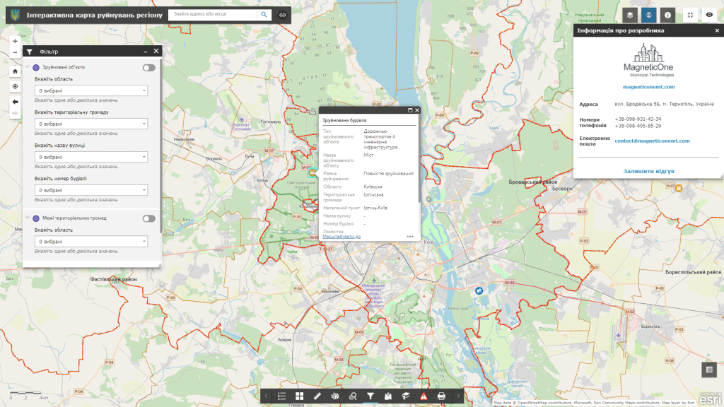
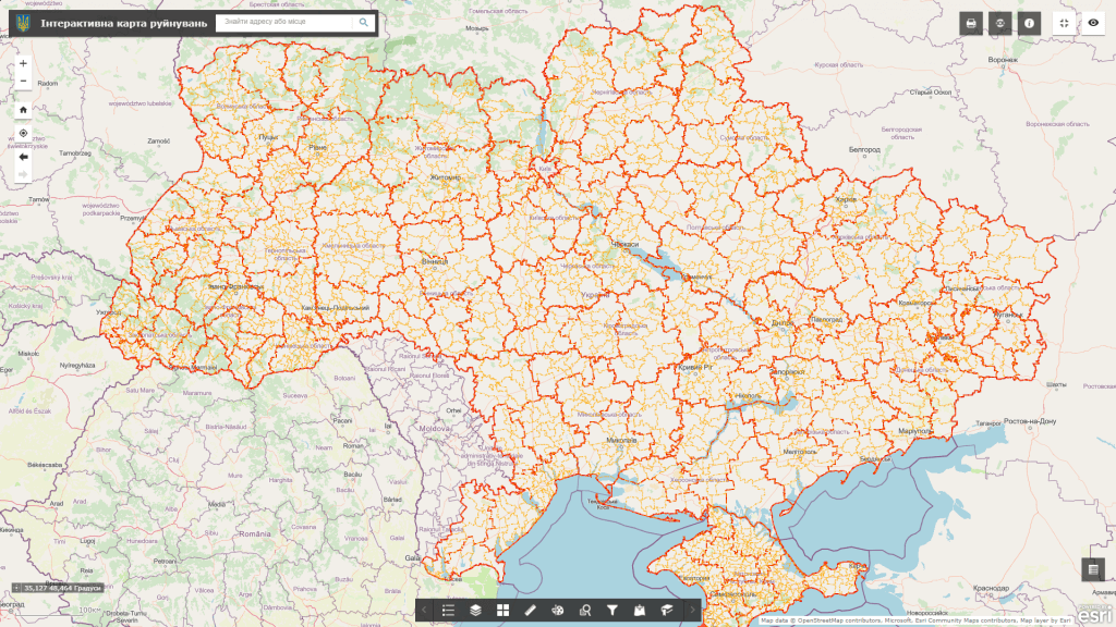
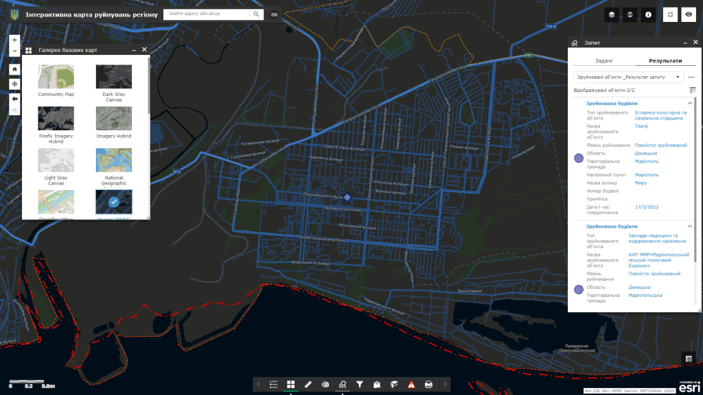
Features of the interactive map:
- an intuitive system for recording and conducting audits of destroyed buildings and structures in real time on an electronic map;
- the user does not need special software to work, it is enough to have a web browser and an Internet connection;
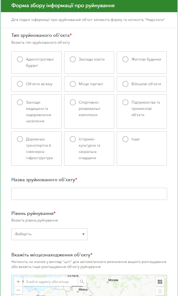
- the possibility, in addition to textual descriptions, to record a photo report of the destroyed object, to transmit its exact coordinates, to assess the urgency of its restoration;
- filtering objects by sectors (housing and communal economy, social sphere, transport sphere, administrative buildings, educational institutions, historical and cultural heritage, etc.), urgency of their future restoration, territorial principle (community, district, region, country);
- the user does not need special software to work, it is enough to have a web browser and an Internet connection;
- round-the-clock possibility of fixation, constant readiness of the resource for work;
- the ability to process large volumes of object audits, collect data on destroyed buildings and monitor their restoration;
- regulated access to information resources thanks to the assignment of roles to system users (administrator, operator, editor).
Advantages of using an interactive map for the management of the municipality:
- automation of recording, accounting and subsequent restoration of property and infrastructure through the implementation of electronic services for registration and exchange of spatial information;
- visualization of the actual state of property and production assets of the municipality on an interactive map;
- the effect of presence and completeness of information perception during the survey and recording of destruction on the territory;
- ensuring publicity in the restoration and rebuilding of the infrastructure, joint solution of the problems of the city, community, region, increasing the comfort of living of the population and improving the quality of the urban environment after the occupation;
- operational access, administration and updating of information on the progress of works on fixing destroyed objects;
- providing citizens with access to information about the state of destroyed social infrastructure, real estate, transport, etc.
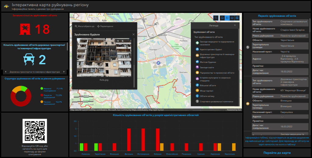
Interactive map data set:
- destroyed administrative buildings (courts, premises of village and city councils, objects of social protection of the population, premises of the RDA and ODA, etc.);
- destroyed sports and entertainment complexes;
- destroyed educational institutions (schools, kindergartens, educational institutions, universities, etc.) and medical institutions (hospitals, polyclinics, medical centers, rehabilitation centers);
- destroyed medical institutions (hospitals, polyclinics, medical centers, rehabilitation centers);
- destroyed residential buildings (high-rise buildings and blocks of residential buildings, private estates);
- destroyed industrial facilities (plants, factories, warehouses, etc.);
- destroyed road transport and engineering infrastructure (bridges, tunnels, roads, railway stations, airports, sea and river ports, etc.);
- destroyed historical, cultural and sacred heritage (churches, cathedrals, squares, monuments);
- destroyed places of trade and provision of services (shopping centers, shops, markets, etc.);
- destroyed military facilities (military units, training grounds);
- destroyed communication facilities (television towers, etc.).
Interactive map modules:
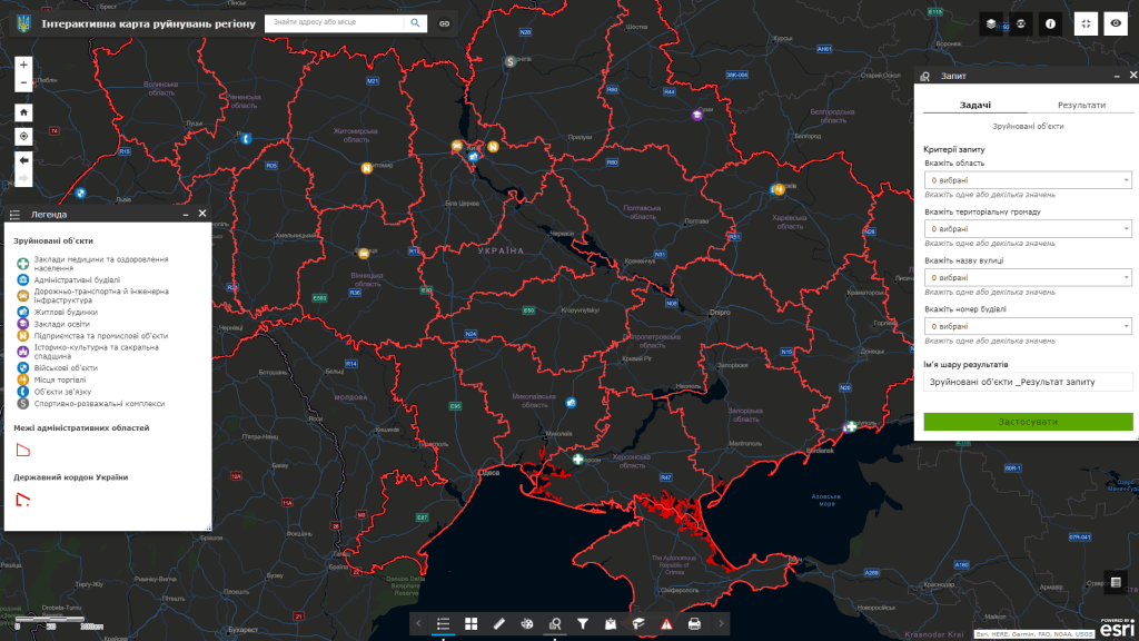
- electronic map visualization subsystem of destroyed residential, socio-cultural, infrastructural and other objects in combination with popular cartographic resources (Google Maps, OpenStreetMap);
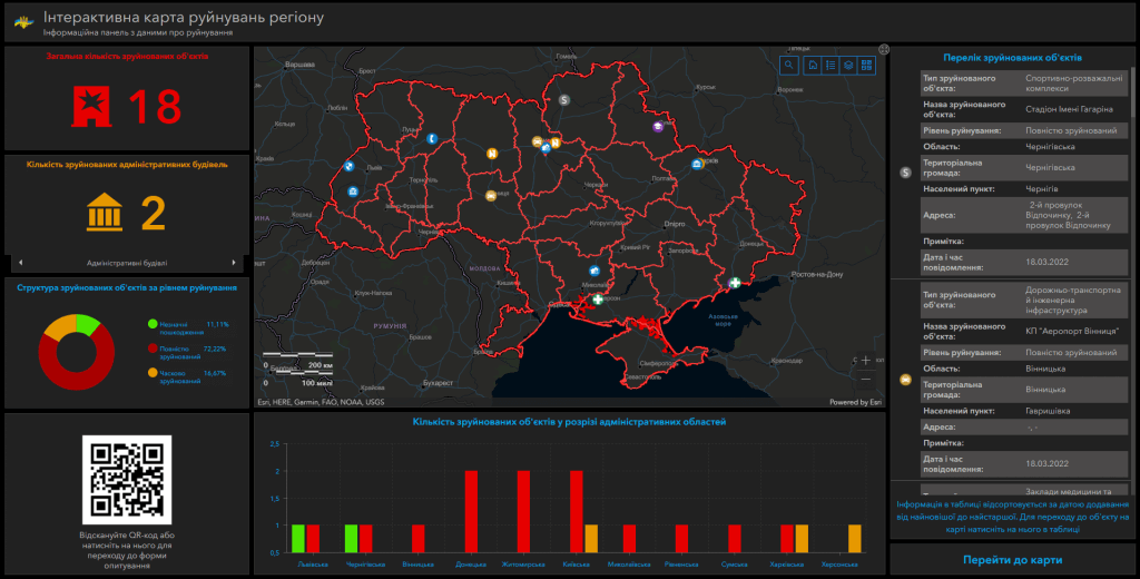
- subsystem of visualization of destroyed objects in the form of graphs, diagrams, tables compiled on one information panel (dashboard);
- a subsystem of the operational inventory of destroyed buildings, synchronized with the geo-information platform.
The cost and thatroomand order fulfillment
- MagneticOne Municipal Technologies provides a full range of services for the development of an interactive map of destruction, namely the supply, installation and configuration of hardware and software, filling the map with data, training specialists, technical support and support of the interactive map. Development terms are agreed upon additionally.