Geoinformation system (GIS) of natural resource management– a module of the geographic information system of the region or community, intended for the preservation, accumulation, display and analysis of information about natural resources. GIS is designed to ensure efficiency and quality of work with spatial information in the field of water and forest resources management, minerals, nature conservation areas, waste management. The implementation of the geoinformation system is aimed at providing information support to state bodies, interested enterprises, institutions and organizations with information necessary for solving issues of sustainable development, as well as providing public access to the information database of the components of the natural environment.
Geoinformation system of natural resources management
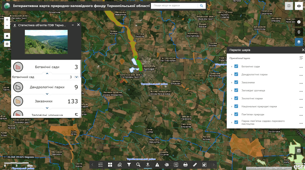
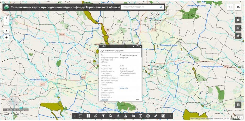
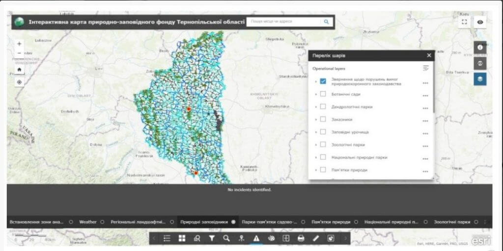
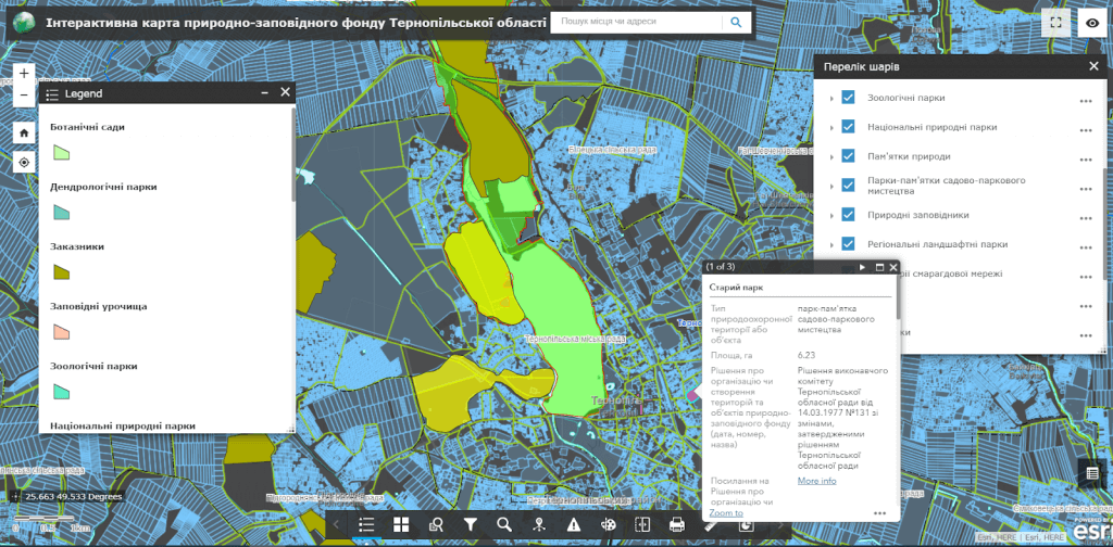
Opportunities of the Geoinformation system of objects and territories of the nature reserve fund of the region
- visualization of data in the field of nature use (water, forest and subsoil use) on an electronic map in the mode of combining with the modern administrative and territorial system, cadastre data (land, urban planning, water, environmental);
- creation of a joint effective information field for separate subdivisions of authorized bodies in the field of environmental activities and natural resource management;
- maintenance of detailed passports of objects (water, forest, nature reserves, mineral resources, etc.), execution of spatial and attributive requests, possibility of search;
- production of graphic (including cartographic) documents for information service of the population, local self-government bodies, organizations and institutions;
- recording of appeals from citizens about violations of legislation in the field of nature management.
Modules and subsystems of the geoinformation system of natural resources management
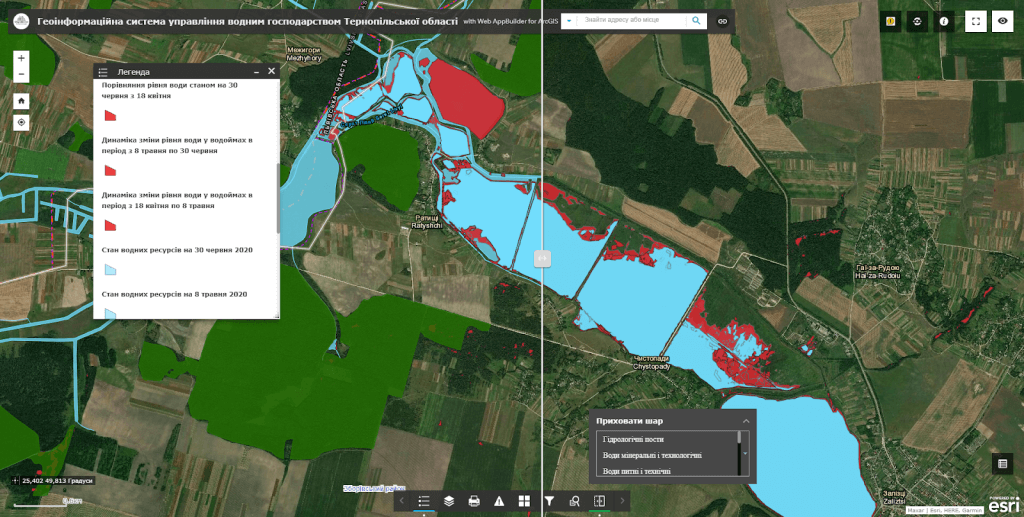
- Subsystem of water resources managementdesigned to automate the process of maintaining the register and certification of water and water management objects, to ensure monitoring of the quality of management of basin systems in emergency situations (floods, floods), to model and forecast inundation zones based on aerospace data, etc.
- Forest resource management subsystemsolves practical tasksregarding the development of measures aimed at ensuring the rational management of forestry and use of the forest fund, effective reproduction, protection and protection of forests, monitoring of deforestation in a mode close to real time.
- The management subsystem of the nature reserve fundaimed atprovision of information support participants of nature protection activitiesin the form of electronic maps, creating conditions for the implementation of successful environmental protection activities through the analysis of the bequest objects and providing the user with the opportunity to make informed decisions based on digital models.
- Mineral resource visualization subsystemprovides support in solving the practical problems of accounting for mineral deposits, analysis and assessment of resource availability of the region.
- Environmental situation monitoring subsysteminvolves the visualization of measures aimed at the rational use of natural resources, the display of pollution sources, landfills.
- Waste management subsystemserves as a decision-making tool in the field of solid waste management (SWW), a visualization toolthe current state and phasing of implementation of local and regional solid waste management programs. The system is aimed at solving problems related to the collection of data on the current state (inventory) of landfills and landfills of solid waste, certification of landfills and landfills, visualization of schemes for sanitary cleaning of settlements, development and optimization of logistic schemes of routes of garbage collection equipment for collection and removal of solid waste in the relevant territory, development of ecologically and economically optimal practices of solid waste management.
- Subsystem “Personal account of the user”designed to automate activities in the field of natural resource management by providing the possibility of generating standard documents and reports (copies, certificates, information sheets, etc.) according to a given algorithm.
- Subsystem of public electronic appealsregarding violations of legislation in the field of environmental protection legislation using mobile devices.
- Subsystem of ecological inspection of natural resourcesby means of mobile devices in real time.

The cost and thatroomorder execution details:
MagneticOne Municipal Technologies provides a full range of services related to the development of a geographic information system, namely: supply, installation and configuration of hardware and software, filling the register with data, training of community specialists, technical support and support of the GIS module. The terms of development of the module are agreed upon additionally.
Tell us about your project and our specialists will suggest the appropriate implementation format.
Services that precede the implementation of the geoinformation system:
- Consulting
- Scanning maps and documents
- Georeferencing cartographic materials
- Digitization
- Geospatial database population