
Geoinformation system of power supply networks

Use an automated information systemM1MT: Taxation of real estate and land plotsfor the effective functioning of the tax system at the level of local territorial entities (territorial communities, cities and villages). GISintended for automating the functions of tax collection in the local budget, conducting a comprehensive operational analysis of taxation objects, providing management bodies and relevant levels of tax services with verified information.

The purpose of the implementation of M1MT: Taxation of real estate and land plots is control over compliance with the legislation on taxes in the area of real estate and land plots, the correctness of their calculation, the completeness and timeliness of the introduction of local taxes established by law into the relevant budgets.
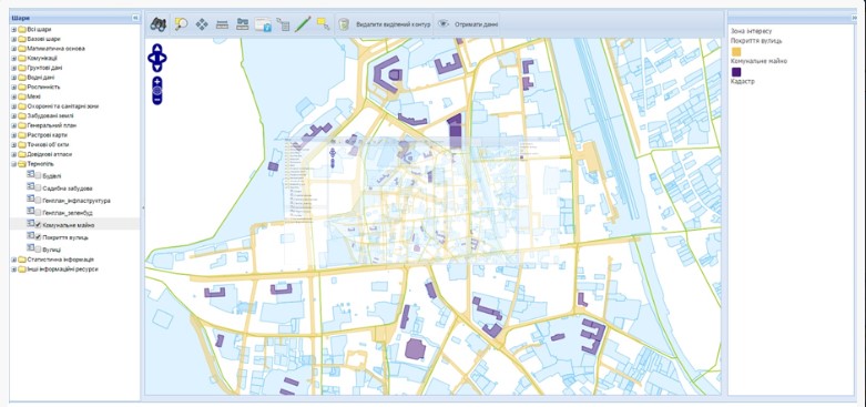
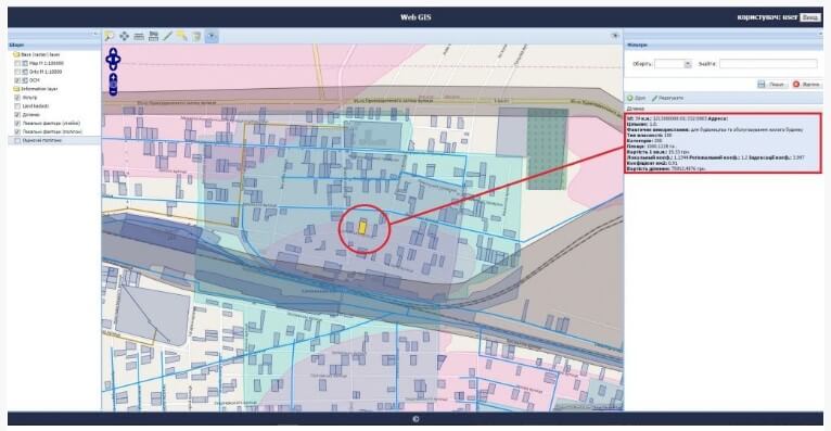
New possibilities of the local budget together with M1MT: Taxation of real estate and land plots

  • increase the effectiveness of the functioning of the taxation system due to the efficiency and improvement of the quality of the decisions made;
  • create a single spatial register of taxation objects,increase local self-government budget revenues and optimize real estate management; 
  • increase the reliability of data on the accounting of payers and the effectiveness of control over compliance with tax legislation;
  • ensure the speed of receiving data, analyze the dynamics of tax receipts and the possibility of forecasting these dynamics;
  • impose financial sanctions provided for by law for its violation and ensure their correct application;
  • receive operational data on the actual receipts of taxes and payments to the budget.

M1MT: Taxation of real estate and land plots is to promote the comfort of local residents through

  • ensuring the correctness of calculation and control over the timeliness of tax payments to the budget;
  • avoiding discrepancies between the data of the controlling bodies and the data confirmed by the taxpayer on the basis of the originals of the relevant documents, information from which can be entered online;
  • reduction of the volume of paper document circulation.   

The structure is spaciousof the M1MT database: Taxation of immovable property and land plots

  • basic geoinformation resources: a single cartographic base with a register of geographical names (streets, rivers), a layer of buildings and structures, land plots, etc.;
  • thematic information resourcessupplemented by the appropriate attributive component: the nature of buildings and structures according to their functional use (residential, commercial purpose), social infrastructure objects, agricultural land;
  • complex or problem-oriented information resources, as a set of basic and thematic resources that are combined into a certain system with the formation of a new resource for solving a problem, for example, the display of buildings with an area of ​​more than 120 square meters. or land plots for which tax arrears remain, etc.

Services that precede the creation of GIS

  • Консультування
  • Сканування паперових документів та карт
  • Просторова прив'язка картографічних матеріалів
  • Оцифрування
  • Наповнення бази даних ГІС