
Industry, resources and supply chains
Spatial picture of industrial potential and risks
The platform connects businesses, supply chains, infrastructure, labor, energy and logistics for industry analysis, investment planning and industrial resilience.

For which management decisions
Industrial Intelligence helps to see not individual enterprises, but their dependencies, territorial clusters, bottlenecks and opportunities for cooperation.
Industry structure
Concentration of production, specialization of territories, key enterprises and related sectors.
Supply chains
Dependence on raw materials, components, energy, logistics hubs and sales markets.
Investment decisions
Comparison of sites, infrastructural readiness, workforce base and territorial limitations.
Resilience and relocation
Assessment of critical dependencies, alternative routes, backup suppliers and relocation opportunities.
What data does the system combine
The list of sources is determined during the discovery stage. The system can combine spatial, registry, statistical, documentary and operational data without public disclosure of information with limited access.
Enterprises
- industry, products and capacities
- industrial relations and cooperation
- employment and the need for personnel
Resources
- raw materials and material flows
- energy, water and engineering networks
- land and industrial sites
Logistics
- roads, railways and nodes
- warehouses, terminals and throughput
- routes, lead times and risks
Context
- environmental and urban planning restrictions
- risks and safety factors
- investment programs and incentives
Key analytical modules
Modules can be customized for an individual industry, industrial cluster, region or national system.
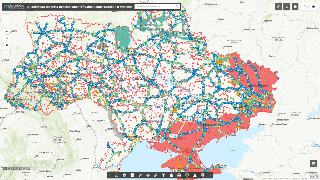
Industrial atlas
Map of enterprises, specialization, capacities, sites and supporting infrastructure.
Graph of supply chains
Visualization of cross-industry connections, critical dependencies and potential partners.
Investment screening
Comparison of territories and sites according to a set of technical, resource and economic criteria.
Resilience monitoring
Risk indicators, logistics disruptions, resource shortages and alternative scenarios.
How implementation works
We define management tasks, users, available data and access requirements.
We agree on classifiers, indicators, integrations, quality rules and updates.
We configure priority maps, panels, analysis scenarios and user roles.
We connect new territories, sources, modules, reporting and support.
Usage levels
Architecture can be formed for a national level, a ministry or public agency, a region, a municipality or an individual organization. Each level gets its own set of data, powers, indicators and reports.
National level
Industrial policy and inter-branch dependencies.
Region
Clusters, specialization and investment priorities.
Municipality
Sites, infrastructure and local employment.
Enterprise
Supply, assets, risks and cooperation.
Related solutions and services
The platform can work as an independent analytical system or as an add-on to existing registers, geoportals and industry systems.