
Water resources, infrastructure and risks
The only analytical picture of water is from the basin to the consumer
The platform connects water bodies, basins, water use, water quality, hydrotechnical and utility infrastructure for demand balancing, condition monitoring and risk management.
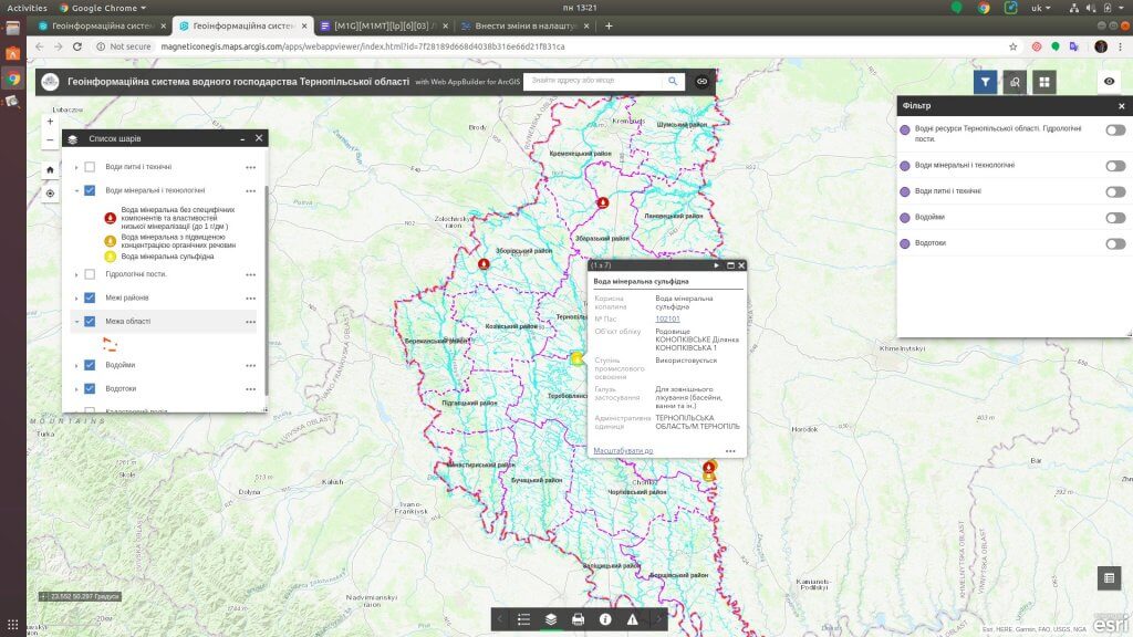
For which management decisions
Water Intelligence supports the basin principle of management while providing a practical level of detail for a region, community, water utility or other organization.
Water balance
Comparison of available resources, intake, consumption, discharges and projected needs by territories and periods.
Water quality
Identification of spatial and temporal changes, risk zones, possible sources of influence and monitoring gaps.
Infrastructure
State of networks, structures, water intakes, wastewater treatment plants, emergency and modernization priorities.
Risks
Droughts, scarcity, flooding, pollution and response scenarios for population, economy and ecosystems.
What data does the system combine
The list of sources is determined during the discovery stage. The system can combine spatial, registry, statistical, documentary and operational data without public disclosure of information with limited access.
Water objects
- rivers, lakes, reservoirs and underground waters
- pools and catchments
- hydrological stations and regimes
Water use
- permits, withdrawals and discharges
- consumers and industry needs
- balances and limits
Quality
- results of laboratory measurements
- indicators of the state of water bodies
- sources of influence and wastewater treatment plants
Infrastructure
- water intakes, networks and structures
- technical condition and accidents
- reconstruction and protection projects
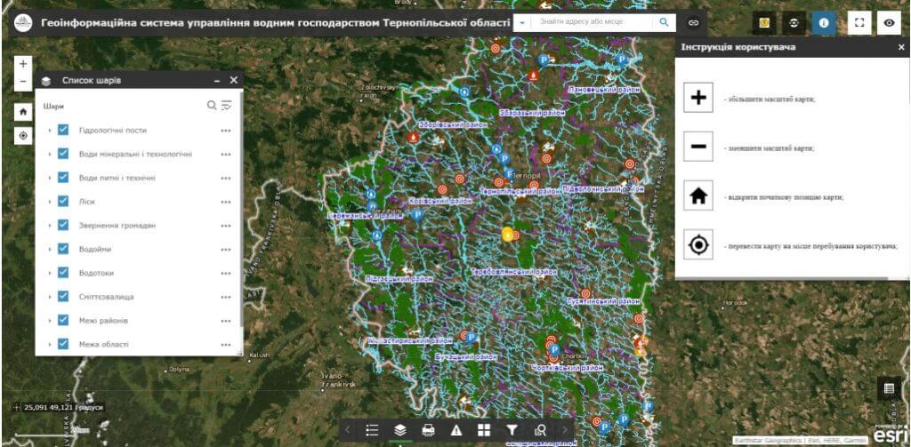
Key analytical modules
The system stores the spatial and temporal context of indicators, measurement units, source, methodology and update date.
Basin map
Water bodies, catchments, posts, users, discharges, structures and territorial restrictions.
Water balance
Resources, needs, shortages, seasonality and climate change scenarios and consumption.
Quality monitoring
Dynamics of indicators, excesses, spatial regularities and data quality control.
Assets and risks
Infrastructure, technical condition, criticality, failures, repairs and investment priorities.
How implementation works
We define management tasks, users, available data and access requirements.
We agree on classifiers, indicators, integrations, quality rules and updates.
We configure priority maps, panels, analysis scenarios and user roles.
We connect new territories, sources, modules, reporting and support.
Usage levels
Architecture can be formed for a national level, a ministry or public agency, a region, a municipality or an individual organization. Each level gets its own set of data, powers, indicators and reports.
National level
Water policy, basin balances and reporting.
Basin or region
Resources, water users, quality and risks.
Municipality
Water bodies, communal infrastructure and local needs.
Operator
Networks, assets, emergency, quality and investment program.
Related solutions and services
The platform can work as an independent analytical system or as an add-on to existing registers, geoportals and industry systems.