
3D, GIS and scenario modeling
A digital duplicate of an area, object or infrastructure
The platform forms a coherent digital model of the real environment, combining 2D/3D geodata, registers, sensors, documents and analytical models for monitoring, forecasting and verification of management scenarios.
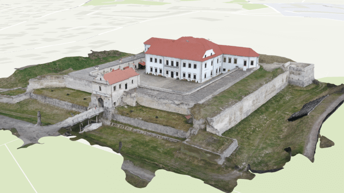
For which management decisions
AI Digital Twin Platform is needed where decisions do not depend on one indicator, but on the interaction of territory, assets, processes and changes over time.
Change planning
Verification of building options, infrastructure, mobility, resource provision and restrictions.
Asset management
A unified digital model of objects, technical characteristics, status, works and interdependencies.
Monitoring
Comparison of the planned and actual state according to the data of surveys, sensors, photos, drones and operating systems.
Forecasting
Using statistical and AI models to detect anomalies, assess risks and scenarios.
What data does the system combine
The list of sources is determined during the discovery stage. The system can combine spatial, registry, statistical, documentary and operational data without public disclosure of information with limited access.
Spatial basis
- maps, orthophoto plans and relief
- BIM, CAD and 3D models
- addresses, land plots and networks
Objects
- passports and technical specifications
- owners, balance holders and contracts
- inspections, defects and repair work
Dynamic data
- sensors and telemetry
- mobile examinations
- events, applications and incidents
Models
- rules and calculation models
- forecasts and risk indicators
- development and optimization scenarios
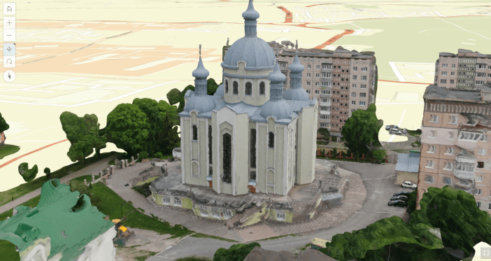
Key analytical modules
The digital double is created gradually: from the basic model and priority processes to the integration of dynamic data and predictive analytics.
2D/3D environment
A visual model of the territory or asset with levels of detail, thematic layers and time slices.
Register of assets
Related spatial features, characteristics, documents, interdependencies, and change history.
Operational monitoring
Events, metrics, alerts, response routes, and performance monitoring.
AI and scenarios
Search for patterns, forecasting, comparison of alternatives and explained recommendations for a specialist.
How implementation works
We define management tasks, users, available data and access requirements.
We agree on classifiers, indicators, integrations, quality rules and updates.
We configure priority maps, panels, analysis scenarios and user roles.
We connect new territories, sources, modules, reporting and support.
Usage levels
Architecture can be formed for a national level, a ministry or public agency, a region, a municipality or an individual organization. Each level gets its own set of data, powers, indicators and reports.
National level
Models of critical systems and national programs.
City or region
Territorial planning, infrastructure and urban processes.
Enterprise
Assets, production processes, energy and maintenance.
A separate object
A building, complex, network or engineering structure.
Related solutions and services
The platform can work as an independent analytical system or as an add-on to existing registers, geoportals and industry systems.