Solve a set of tasks for collecting, storing, displaying and analyzing spatial and other object information related to it.
Home
MagneticOne Municipal Technologies
modern solutions to improve the performance of municipalities through the implementing of geoinformation technologies


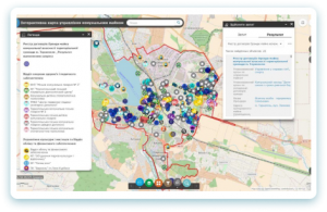
Geoinformation system for the urban environment
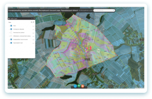
Geoinformation system to manage the potential of rural areas
Implement information databases of spatial and attribute data to improve the efficiency of rural areas
Corporate geoinformation system
Solve a set of tasks for collecting, storing, displaying and analyzing spatial and other related information about objects
Geoinformation system for emergency solutions
Expect potential dangers in emergencies, reduce negative impacts on people's lives, the economy and the environment
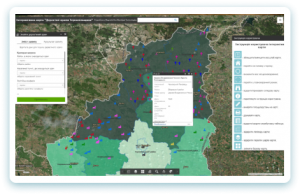
City audit and inspection platform
Publicize information on the activities of municipal utilities and receive feedback from the public on the quality of services provided
Mobile geoinformation system
Use the mapping application for mobile devices designed to access, analyze and graphically visualize spatial data

Geoinformation system for agriculture
Use the benefits and new opportunities for managing agriculture and its main resource - land based on geographic information systems

Geoinformation system for management of agricultural potential
Implement information databases of spatial and attribute data to improve the efficiency of rural areas

Geoinformation system for ECO security of the modern city
Reduce environmental risks on the basis of current achievements in cartography and geoinformation technologies
Geoinformation system for forestry
Use the new platform for decision making in the forestry industry
Geoinformation system for construction
Select building plots with all the necessary parameters
Geoinformation system for municipal taxes
Informs the public about the amount of tax payment for a cartographic database published on the Internet
BENEFITS

Long - term experience in the field of geoinformation technology

Powerful product line (22 GIS products)

Internal Quality Control and Customer Satisfaction Assessment

8 realized GIS projects during 2018

An extensive partnership network

14 certificates of professional development for employees during 2018
WHAT WE DO

Solving the problems connected with forecasting directions of development of urban engineering infrastructure and effective management of communal services.
Solving the issue of effective management of natural (forest, water) resources and natural reserve fund.

Providing information support to decision-making in the field of environmental safety of the population, prevention emergencies of natural and human-made nature.
The purposeful and comfortable management of the land resources for the united territorial community, support in the current state of data on the management, domestic and industrial infrastructure of UTC (united territorial community)

WHAT OUR CUSTOMERS SAY
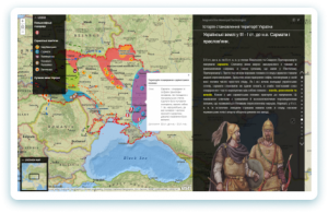
Interactive learning maps of “The history of becoming the territory of Ukraine”
The project is aimed at the use of interactive learning maps as a scientific source of information. This resource will help students navigate in the periodization of history and its important facts: dates, periods, campaigns, battles, historical finds. The concept… Read More “Interactive learning maps of “The history of becoming the territory of Ukraine””

Vivchar Andrii Dmytrovych
Methodist of the Ternopil Communal and Methodological Center for Scientific and Educational Innovation and Monitoring
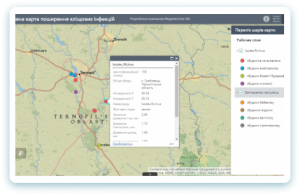
Medical geoinformation system
I express my sincere gratitude to the developers of the medical geoinformation system. The medical geoinformation system is a very timely product, as the increasing of the amount of information in the society grows and it requires the creation of… Read More “Medical geoinformation system”

Fedoniuk Larysa Yaroslavivna
Doctor of Medicine Ternopil State Medical University I.Y. Gorbachevsky


")
")

")