Geoinformation system of utilities

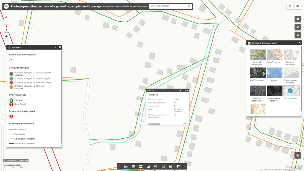
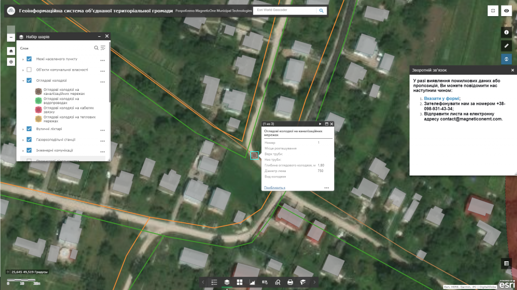
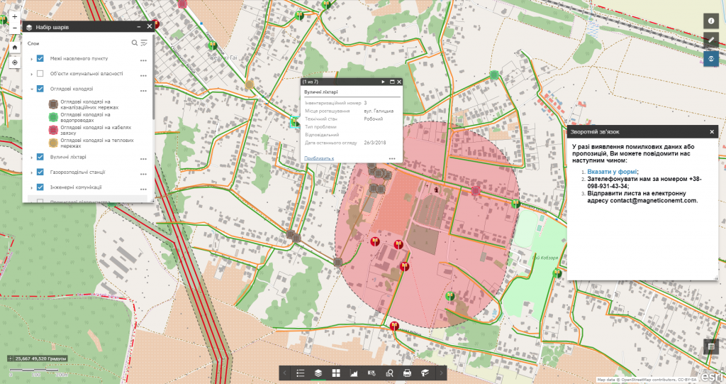
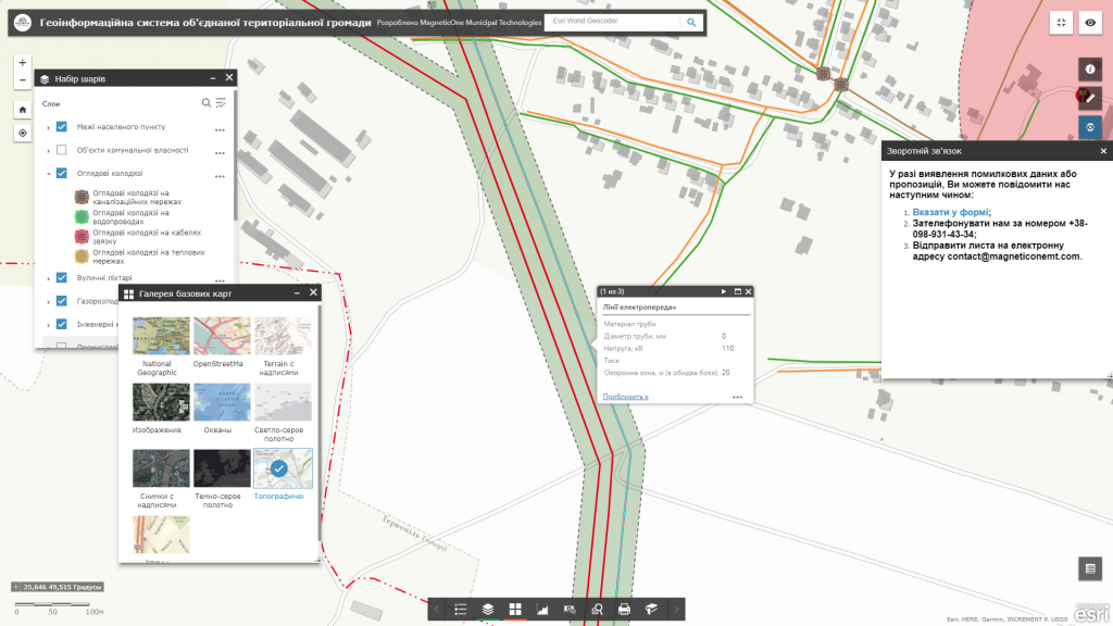
Geoinformation system of utilities – is intended to automate the daily work of experts in the field of urban planning and architecture, municipal dispatching services (water supply, electricity, etc.) – getting precise coordinates of engineering network objects and their main parameters, information about mutual arrangement of networks of different types, defining landmarks to indicate the place of an accident, distance to the nearest buildings, highway, etc.) Implementation of GIS reduces the risks related to the safety of employees of communal enterprises. The functional of the geographic information system is adapted to meet the needs of central and local executive authorities, local authorities, communal enterprises and citizens. Such a GIS, for example, when designing a high-voltage power line route, will warn of a dangerously close location to the old water main, will indicate the date of its setting into operation or overdue maintenance, which altogether may lead to an emergency situation caused by a pipe break near the power line.

The introduction of GIS utilities is a significant step towards the integration of diverse administration information systems into a single platform for efficient management of urban infrastructure.
Створення інтерактивної карти

Address urban planning issued with geoinformation system of utilities

  • get quick access to utilities information. So, for example, using GIS, an emergency crew will be informed about the technical characteristics of the area of an accident on advance or on-site, will be able to carry out necessary works without the need to search for a suitable well to stop the water supply;
  • predict directions for development of utilities, effectively manage the communal economy of the city;
  • carry out an inventory of production and auxiliary facilities, automate maintenance of technical documentation;
  • carry out operative dispatch control in real time, search for objects of utilities on-site by means of GPS navigation;
  • promptly respond to any accidents and emergency situations (including external, related to a specific type of utilities), locate them;
  • provide information support for preventive and emergency recovery;
  • monitor the state of the environment and prevent accidents;
  • provide interaction with territorial services and management bodies (land cadastre, environmental protection, etc.);
  • reduce time spent on scheduled inspection of utilities using a convenient mobile app with an option to create a photo report on the identified issue, assess the urgency of its addressing, and prompt presentation of inspection results to the management;
  • monitor activity of mobile workers (auditors, inspectors), identify unscrupulous employees and increase the discipline of the team.

The GIS database of utilities includes

  • basic geoinformation resources or mapping basis: a single digital topographic and geodetic base of the city, digital orthophoto maps, digital model of the relief, register of geographical names, etc.;
  • thematic information resources are supplemented with the corresponding semantic component: a register of land plots, register of buildings and constructions, network of utilities of a certain type (material and diameter of water pipes, pressure of gas pipelines, voltage of power cables), register of natural resources of a certain type, register of architectural monuments, highways (type of covering), etc.;
  • complex or task-oriented information resources that are a set of basic and thematic resources, which are united providing resources for addressing a certain issue on managing the territory, as restricted construction areas (protected areas of gas pipelines, sewage networks, power lines, etc.).

Services which will be provided prior to solution

  • Consulting
  • Scanning of paper documents and maps
  • Georeferencing of cartographic materials
  • Digitization
  • Provisioning of the interactive map database
Коротка інформація

[contact-form-7 id=”10714″ title=”Форма партнерства”]


×