M1MT: Health care geoinformation system

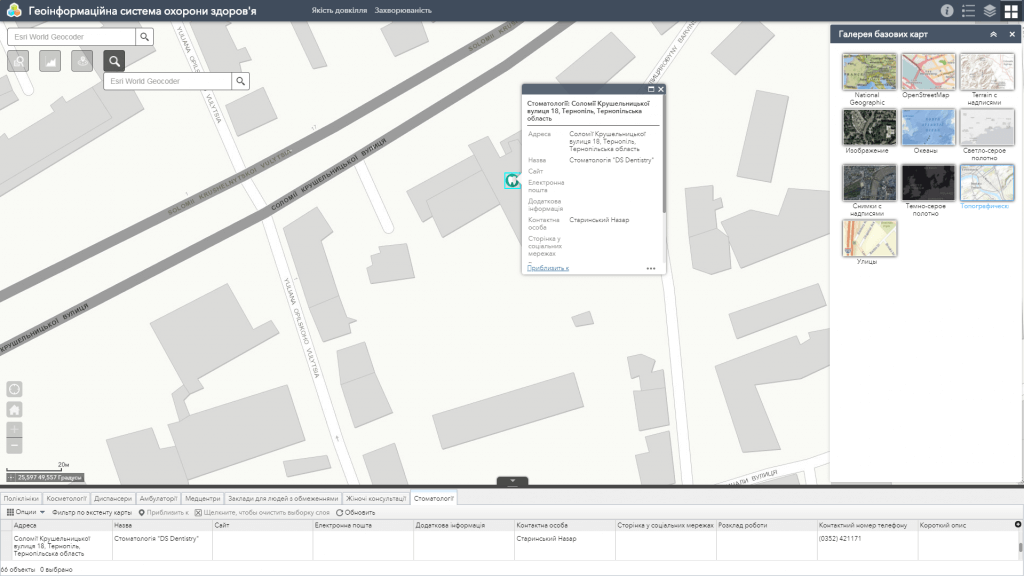
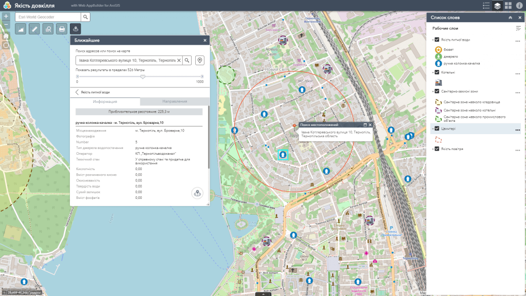
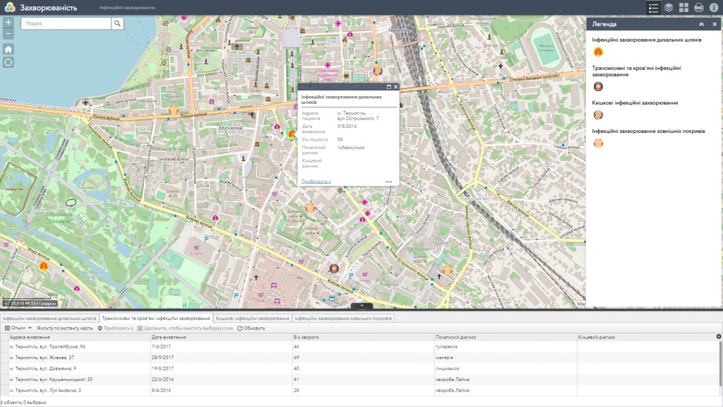
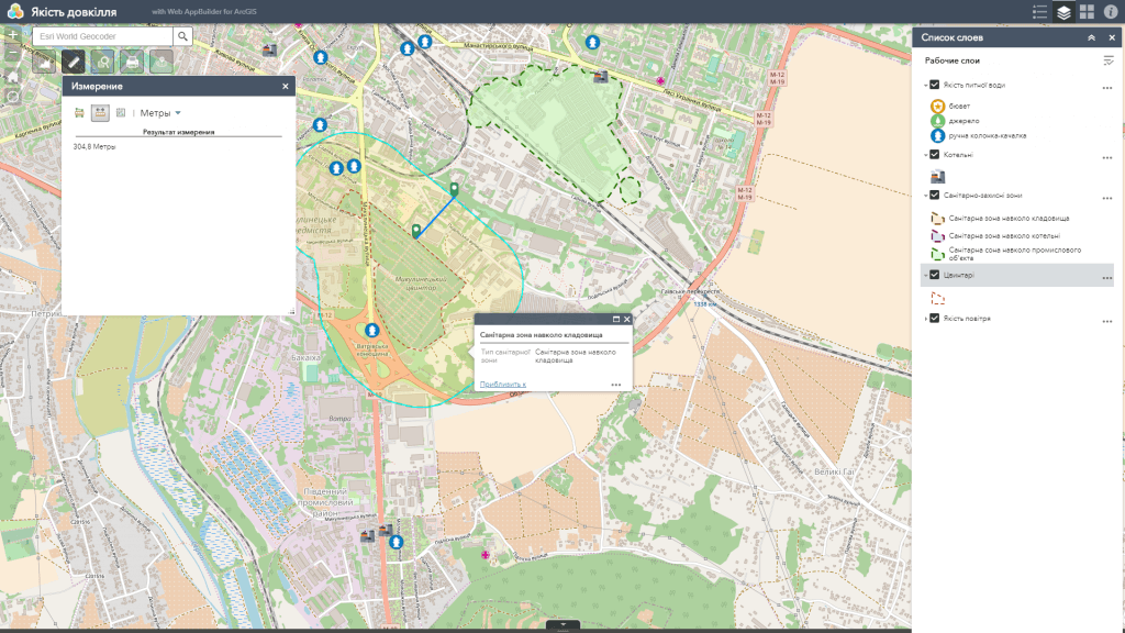
Health care geoinformation system (GIS) – is a specialized medical cartographic and analytical resource designed to collect, store, accumulate, analyze and display information on the spread of diseases, the infrastructure of health care facilities, indicators of the natural and socio-economic environment which affect the health of the population of a particular region.

Use GIS to track the results of the implementation of planned actions, comprehensive analysis of medical data sets for optimal and more adapted to the specific situation of resource allocation in accordance with the current sanitary and epidemiological situation.

Web map features

  • the most complete set of functions: map navigation, data editing, map vector layers, spatial analysis, address search;
  • easy search (including group search by a certain parameter), online update and database editing;
  • a wide range of analytical capabilities (display of information in the form of graphs, spatial and statistical analysis);
  • constant readiness for work;
  • protection of information from distortion and unauthorized access;
  • the possibility of multi-user access and group editing of the database, including in the field with a smartphone;
  • monitoring the medical geographical and sanitary-epidemiological situation on a mobile device.
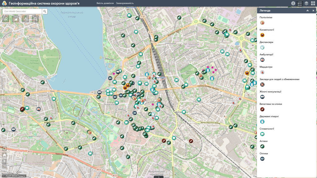
Геоінформаційна система охорони здоров'я

Health care GIS – instrument for monitoring the medical-geographical situation

  • analyze the infrastructure of health care facilities, resources and ongoing programs to improve the level of public health, etc.;
  • get a platform for collecting, analyzing and displaying the factors and indicators of the natural and socio-economic environment that affect the health of the population;
  • get a common operational picture for planning and adjusting actions, including when emergencies arise, such as outbreaks of dangerous diseases and the rapid spread of infections, or at the risk of bioterrorist attacks;
  • get quick access to information about health care services in the community in a wider spatial context;
  • carry out systematic monitoring, accounting and control of the medical-geographical situation of the region;
  • use the query system and intelligent search for spatial analysis of disease prevalence and surveillance of real threats to public health;
  • track in real time the location of emergency city services (ambulance, fire, police).

Indicative set of layers of the GIS

  • infrastructure of health care facilities (hospitals, clinics, dispensaries, dentistry, pharmacies, etc.);
  • factors and indicators of the surrounding natural and socio-economic environment (quality of the air, water, soil, radiation background, etc.);
  • causative agents of infectious diseases, outbreaks of dangerous diseases, average mortality rates by region, including under certain circumstances (road accidents, diseases of various organ systems), etc.
Геоінформаційна система охорони здоров'я

Requirements, cost and timing of the order

To create a health care geoinformation system – the customer must provide in electronic format a database of the diseases spread, indicators of the quality of air, water, etc. (in tabular form of the established sample). Separate columns of the database should provide a date and place (linked to the territory) to identify the infection. If the customer cannot provide the database in electronic format, employees of the contractor’s company may provide digitization services for the relevant documents for an additional fee.
The cost of creating a Health care Geographic Information System depends on the price of software, the number of infectious disease pathogens that need to be mapped, the extensiveness of the database, the number of map editors, and the individual wishes of the customer. The timeframe for creating a GIS is up to 30 days from the moment of the provision of the initial information necessary for its implementation and the signing of a cooperation agreement.

Services to be provided prior to GIS development

  • Consulting
  • Scanning of paper documents and maps
  • Georeferencing of cartographic materials
  • Digitization
  • Provisioning of interactive map database
Коротка інформація

[contact-form-7 id=”10714″ title=”Форма партнерства”]


×