M1MT: Interactive map of drinking water quality

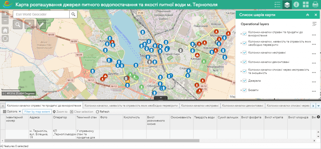
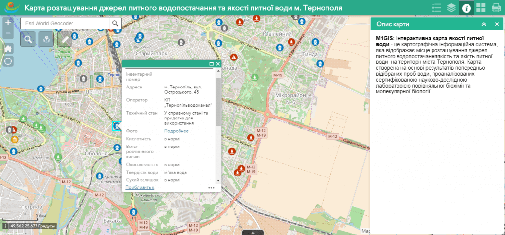
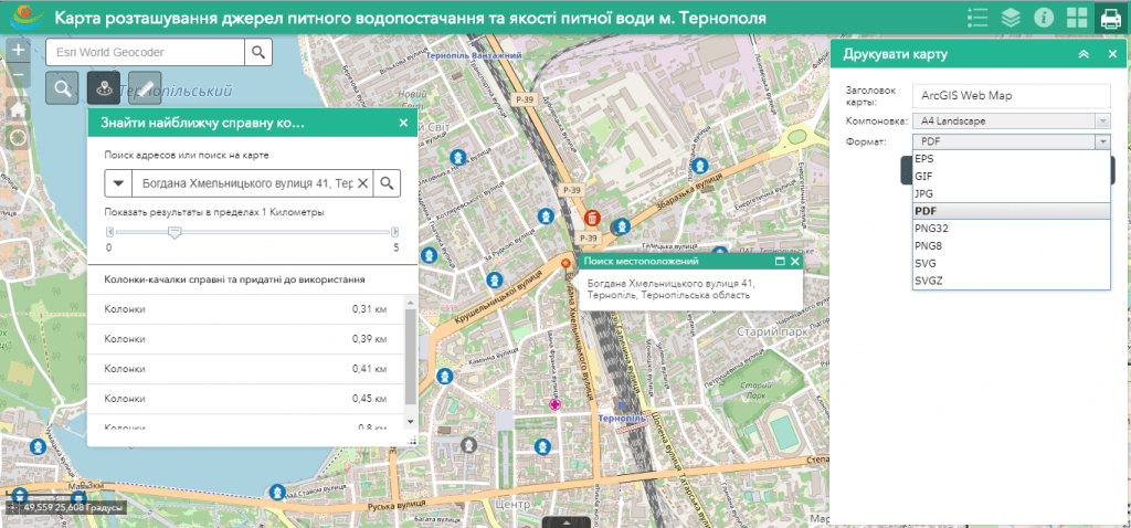
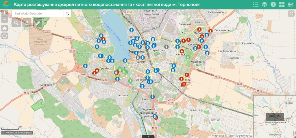
M1MT: Interactive map of drinking water quality – it is a cartographic information system displaying the quality of the drinking water sources in a village, city or territorial community. The map is created based on the results of pre-selected water samples, analyzed by a certified research laboratory. The web map includes information on the location of the drinking water source, water quality indicators. The map functionality allows you to assess the level of pollution by specific substances and track how the concentration of harmful substances in a particular location has changed over time. Thanks to the introduction of the product, citizens have the opportunity to assess the state of the water close to their home or work, to get a tool to influence those responsible for the provision of water services.

Features of the web map

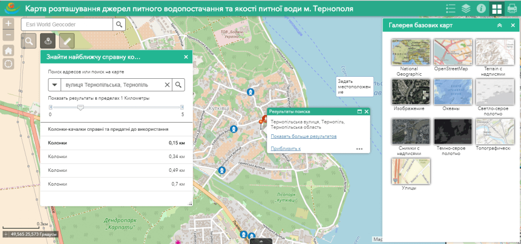
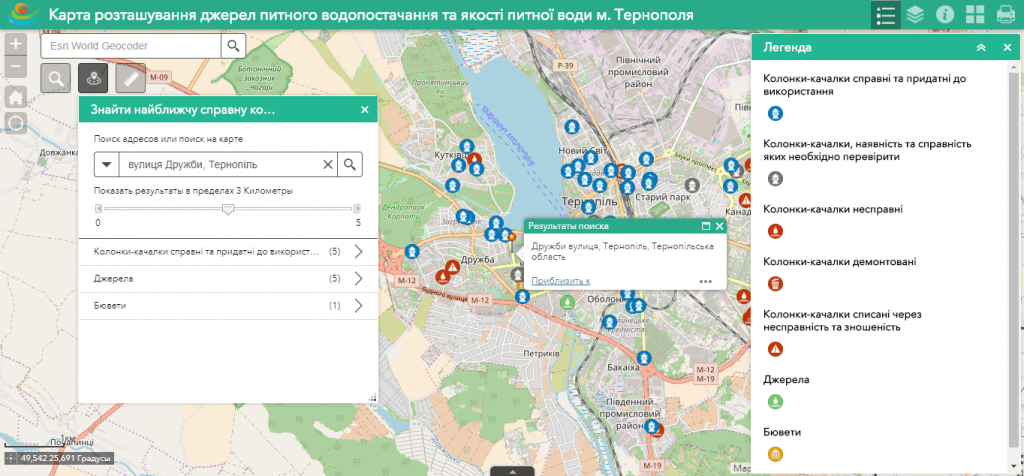
  • navigation on the map, data editing, operating with vector layers of the map, spatial analysis, address search;
  • to work, the user does not need specialized software and qualification of a cartographer, it is enough to have a web browser and an Internet connection;
  • ease of search, quick update and editing of the database;
  • constant readiness for work;
  • protection of information from distortion and unauthorized access;
  • convenient access to information on the map using a mobile mapping app installed on a smartphone or tablet.
Інтерактивна карта якості питної води

Interactive map of drinking water quality – management tool for society

  • get a flexible platform for storing location data, conditions for the drinking water supply sources;
  • carry out systematic accounting and monitoring of drinking water quality, including using a mobile app;
  • ensure the right of citizens to free access to information on drinking water quality, the state of the sources and systems of drinking water supply;
  • based on the results of biochemical analyzes of water samples, plan organizational, scientific, technical, sanitary and epidemiological, environmental, economic, legal measures to improve the quality of drinking water, develop drinking water supply, protect drinking water sources and systems, and restore drinking water supplies;
  • monitor compliance with the legislation in the field of drinking water supply;
  • monitor the status of water sources and the mode of their use for the rational use and protection of water;
  • conduct operational audits of drinking water quality using a mobile application in real time;
  • ensure the maintenance of a single electronic journal of history indicators of the quality of drinking water sources.

A set of layers of the interactive map includes

  • surface waters: rivers, reservoirs, lakes;
  • subterranean waters (groundwater, springs, wells, boreholes, etc.);
  • water from alternative sources of urban water supply (rocking columns, pump rooms, etc.);
  • enterprises that pollute drinking water with an indication of emissions of harmful substances.

Drinking water quality indicators

  • acidity;
  • hardness of water;
  • dry residue;
  • dissolved oxygen content (oxidation);
  • the content of phosphates, sulfates, chlorides, nitrates, ammonia, iron, cadmium, zinc.
Інтерактивна карта якості питної води

Requirements, cost and timing of the order

To create a drinking water quality map, the customer must provide water samples in accordance with the requirements, a list and layout of drinking water supply facilities. The cost of creating an interactive map is based on a number of thematic map layers, the number of water supply facilities that need to be mapped and the number of biochemical water analyzes performed, branching of the database, and individual customer requirements. The deadline for creating a web map is up to 20 days from the moment of the provision of the initial information necessary for its implementation and the signing of a cooperation agreement.


Services that precede map creation

  • Consulting
  • Scanning of paper documents and maps
  • Georeferencing of cartographic materials
  • Digitization
  • Provisioning of interactive map database
Коротка інформація

[contact-form-7 id=”10714″ title=”Форма партнерства”]


×